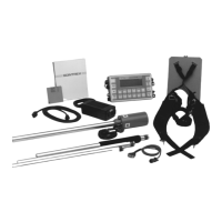
ENVIMAP Reference
C3-22 ENVI-MAG Manual
2. Major contour interval
Even multiples of these contours will be drawn in a heavier weight
and labelled with their respective values.
If you do not specify the major contour interval, all the primary
contours will be labelled.
Note: The major interval must be an integer multiple of the primary
contour interval and should only be specified when a primary inter-
val has been entered. The labels of the contours face up-gradient.
3. Suppress contours in high gradient areas?
A YES or NO option.
When this is enabled, only the major contours will pass through
areas of high gradients and the intervening primary contours will
be feathered out.
Gridding options
In order to produce a contour map, the data must first be interpolated
to values at the nodes of an even grid. The distance between the grid
nodes is referred to as the grid cell size. The cell size is in ground units.
1. Grid cell size
A suitable grid cell size is chosen automatically for the data. If the
contours appear to be too angular, try to reduce the grid cell size
until a satisfactory map is obtained.
Hint: A grid cell size that is equivalent to 1 to 3 mm on the plotted
map is usually adequate. You will need to consider the scale of your
map and the density of your data at this stage.
2. Blanking distance
This is a value in ground units. Any areas that are farther than this
distance from the data points will not be gridded/contoured.
Caution: If this value is set for too small a value, you may get
unwanted holes in your contoured results.
 Loading...