STONEX R2
The height of the line start point is always used as the reference height.
To give a better overview, the graphics are designed in accordance with the scale.
Therefore it‟s possible that the station point moves in the graphic.
Be aware that the start point and the end point of the line are measured in the
previous coordinate system. When staking out these points they appear in the old system
and appear as shifted.
pressing .
C:If the point does not exist, user is
required to input the coordinate.
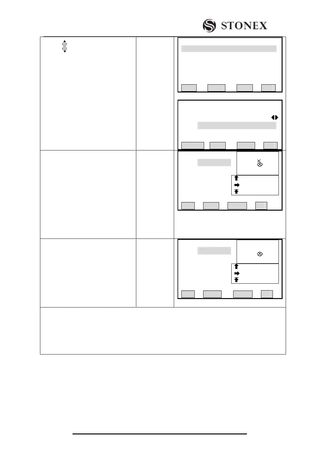
【Pt Search 】 1/25
12 Known
12 Meas.
12 Meas.
12 Meas.
12 Meas.
12 Meas.
VIEW ENH JOB OK
【Pt Search】
Job: STONEX
PtID: 56
Select job/input Pt coord
SEARCH 0SET ENH OK
③ Collimate the prism center, press
[F2] (DIST) to start measurement, the
screen will display longitude, latitude
and height difference between target
point and the line. The upper right
graphic displays the relation between
prism point and stake-out point. Lower
right displays a precise offset value
and offset direction with an arrowhead.
【Stake Out 】
PtID: 3
R.HT : 1.500 m
Ln: 1.971 m
Of: 0.058 m
H: 2.128 m
All DIST CHECK ↓
④ Move the prism according to the
graphic. When both longitude and
latitude arrowhead display zero, it
means the stake-out point has been
found; H means the filling. Method to
stake-out is the same as“5.6 Stake
Out”. ‴2)
【Stake Out 】
PtID: 3
R.HT: 1.500 m
Ln: 1.971 m
Of: 0.058 m
H: 2.128 m
All DIST CHECK ↓
‴1) To shift the line horizontally, press [F3] (ShiftL).
‴2) Longitude offset direction is positive (Arrowhead upwards): Target point is further away from
measurement point.
Latitude offset is positive (Arrowhead rightwards): Target point is on the right of measurement point
H is positive (Arrowhead upwards): Target point is higher than measurement point.