STONEX R2
Explanation for Point ID:
The number behind C is the chainage.
+ Means to stake out points of the right chainage. While staking out points of the left
chainage, it shows “-”.
+ (or-) behind the number is the distance between points of right chainage and central line,
i.e. the data of the right offset (or left offset) data. Here, the points on the central line read
0.0.
For instance: PtID C100+2.0 expresses the point on the right chainage is 2 m away from
the central line, with a chainage of 100.
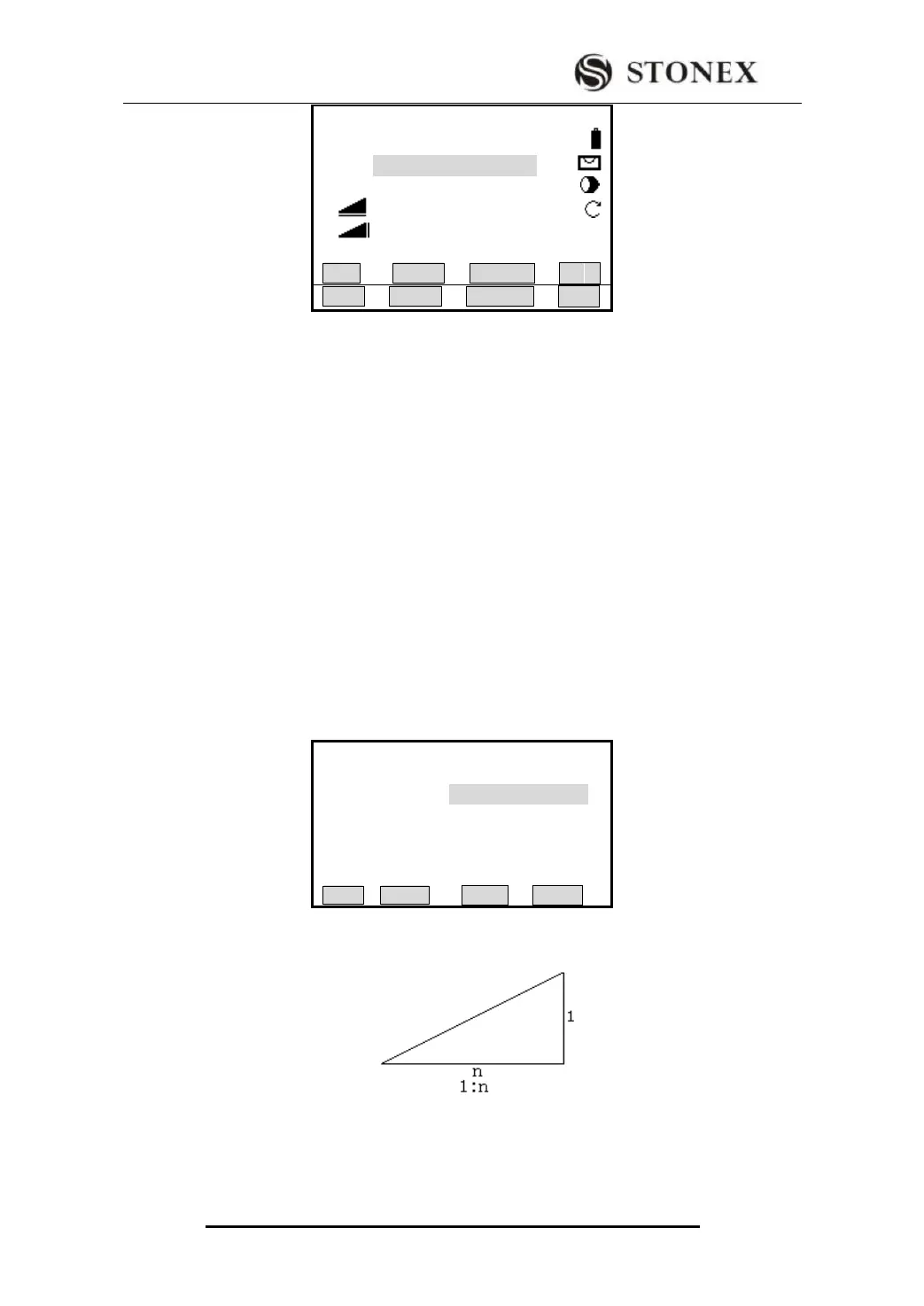
5.12.8 Slope Stake-Out
Slope Stake Out can be launched as part of the Alignment Stake-Out. It is a must to define
horizontal and vertical alignments in Road menu previously. In stake-out main screen,
press [F1] (SLOPE) to display Slope Stake Out.
Main Screen of Slope Stake Out
Indeed, the fill/ cut value that are input here is a ratio.
The fill/dig data can be entered through left and right slopes. In terms of fill/dig, use
positive symbol to input the required slope, the software selects an appropriate slope in
the list according to the actual position of the point.
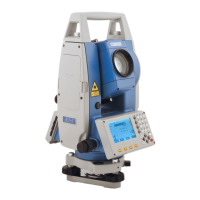
【AlignmentS-O】1/3 ▼
PtID: C100+0.0
R.HT: 2.000 m
△Hz : 20°00′05″
△ : 25.369 m
△ : ---.--- m Ⅰ
All DIST RECORD ↓
【Slope Stake Out】
Left(1:n)
Cut : 1.350
Fill : 1.000
Right(1: n)
Cut : 1.200
Fill : 1.650
LEFT RIGHT