The exact geographic position (location and elevation) of the antenna your Ver-
saSync unit— and thus its onboard GNSS receiver— is a major factor for Ver-
saSync to calculate an accurate System Time from the GNSS reference.
Note: The elevation (altitude) should be set in accordance with the
World Geodetic System 1984 (WGS84), not Mean Sea Level (MSL).
Normally, the onboard GNSS receiver will track and adjust the antenna position
during the so-called GNSS self survey, which is performed during initial com-
missioning of a VersaSync unit, or when rebooting a unit after it had been
powered down for some time ("cold start").
Depending on where your GNSS antenna is installed and thus, how good the
reception is, the self survey may be adequate for most applications.
Setting a Manual Position, however, i.e. manually applying your current geo-
graphic position data (Latitude, Longitude, and Altitude) may be necessary if
your GNSSreceiver could not complete its survey due to poor reception.
In some cases, setting the position manually may also help to reduce the amount
of time needed for the initial position "fix", i.e. for VersaSync to synchronize with
the satellites in view.
Note that this position will also be used if Apply A-GPS Data is checked.
To manually set your position:
1. Determine your geographic position. For more information, see "Determin-
ing Your Position" on the next page.
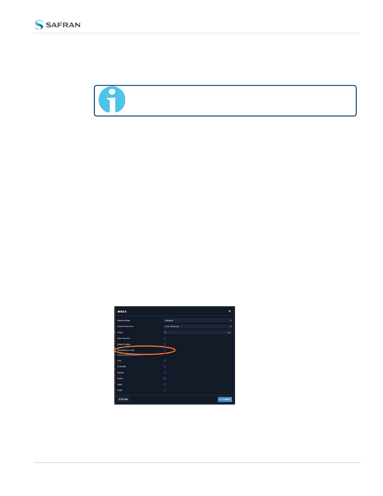
2. Navigate to INTERFACES > REFERENCES: GNSS0. In the GNSS0 status
window, click Edit in the lower left corner. The GNSS0 window will open:
3. Under Manual Position Set accurately enter latitude, longitude (both in
decimal degrees), and altitude (in meters [WGS84]) of your GNSS
3.3 Managing References
CHAPTER 3 • VersaSync User Manual Rev. 12
211