190-01263-01 Rev. A
Garmin G2000 Pilot’s Guide for the Cessna T240
205
Flight ManageMent
SYSteM
OVeRVieW
Flight
inStRUMentS
eiS
aUDiO Panel
& CnS
Flight
ManageMent
haZaRD
aVOiDanCe
aFCS
aDDitiOnal
FeatUReS
aPPenDiCeS inDeX
oBStacleS
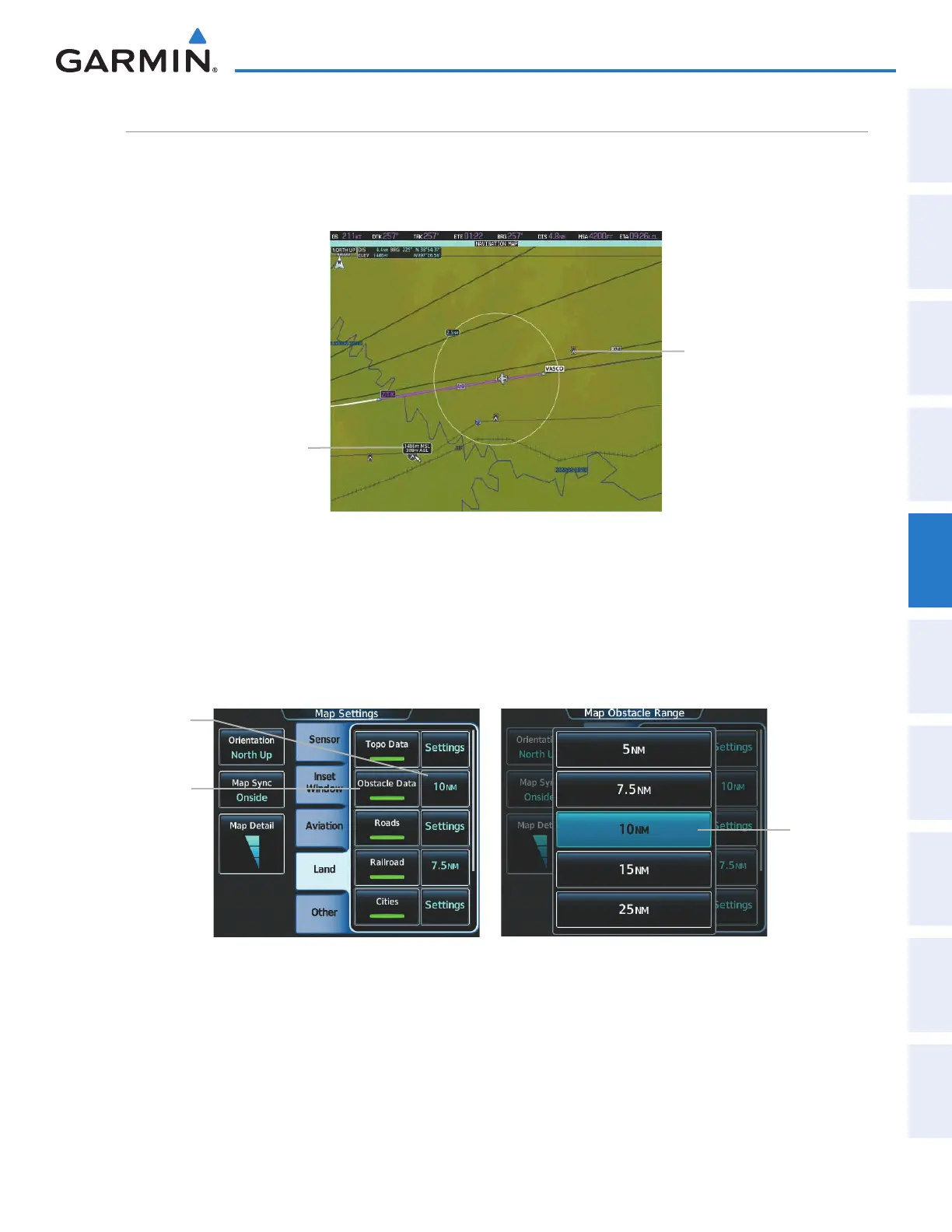
The navigation map can display the location of obstacles (e.g. towers). The obstacles are shown as red, yellow,
or gray, depending on the height relative to the aircraft AGL altitude. See the Hazard Avoidance section for more
details on symbol and color usage.
Figure 5-33 Navigation Map - Obstacles
Obstacle Data Displayed
when selected by the
Pointer
Obstacle
Displaying/removing obstacles:
1) From Home, touch Map > Map Settings.
2) Touch the Land Tab, if necessary.
3) Touch the Obstacle Data Button to display/remove the obstacles.
Obstacle
Data
Button
Figure 5-34 Map Options Screen - Airways Setup
Range
Selection
Button
Range
Button
Selecting the obstacle data range:
1) From Home, touch Map > Map Settings.
2) Touch the Land Tab, if necessary.
3) Touch the obstacle range button to display the range selection buttons.
4) Touch a range selection button to select the maximum map display range.
This manual downloaded from http://www.manualowl.com