190-01263-01 Rev. A
Garmin G2000 Pilot’s Guide for the Cessna T240
189
Flight ManageMent
SYSteM
OVeRVieW
Flight
inStRUMentS
eiS
aUDiO Panel
& CnS
Flight
ManageMent
haZaRD
aVOiDanCe
aFCS
aDDitiOnal
FeatUReS
aPPenDiCeS inDeX
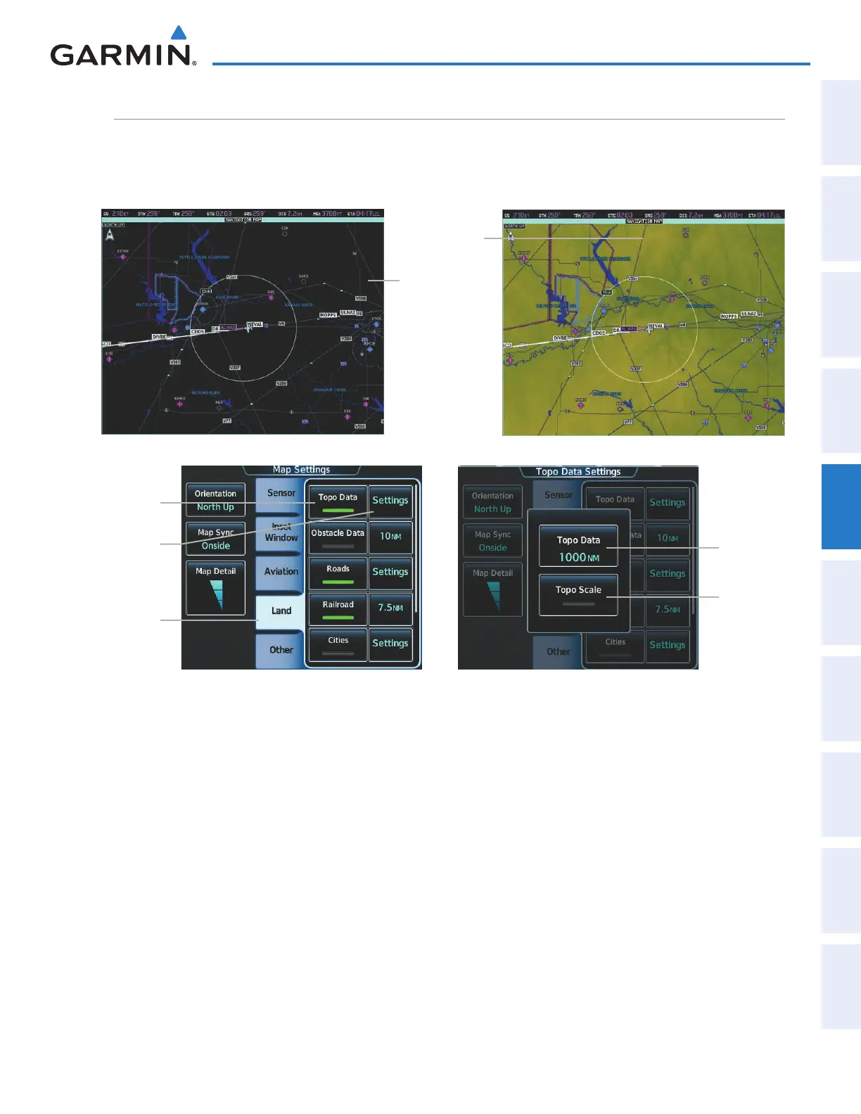
topography
All navigation maps can display various shades of topography colors representing land elevation, similar
to aviation sectional charts. Topographic data can be displayed or removed as described in the following
procedures.
Topo
Scale
Button
Land Tab
Topo Data
Button
Topo Data
Settings
Button
Topo Data
Button
Navigation Map
Black Background
TOPO Off
Figure 5-14 Navigation Map - Topographic Data
Navigation Map
Topographic Data
TOPO On
Displaying/removing topographic data on navigation map panes:
1) From Home, touch Map > Map Settings.
2) Touch the Land Tab, if necessary.
3) Scroll the list to find the Topo Data Button, if necessary.
4) Touch the Topo Data Button to display/remove topographic data on the navigation map.
This manual downloaded from http://www.manualowl.com