Garmin G2000 Pilot’s Guide for the Cessna T240
190-01263-01 Rev. A284
Flight ManageMent
SYSteM
OVeRVieW
Flight
inStRUMentS
eiS
aUDiO Panel
& CnS
Flight
ManageMent
haZaRD
aVOiDanCe
aFCS
aDDitiOnal
FeatUReS
aPPenDiCeSinDeX
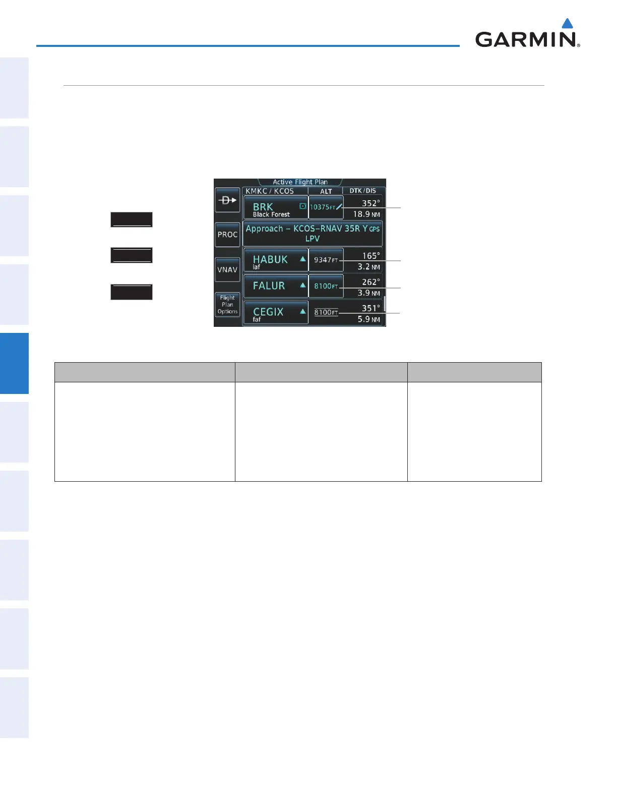
altitude conStraintS
The system can use altitude constraints associated with lateral waypoints to give guidance for vertical
navigation. These altitudes are, depending on the specific instance, manually entered or retrieved from the
published altitudes in the navigation database. The navigation database only contains altitudes for procedures
that call for “Cross at” altitudes. If the procedure states “Expect to cross at,” then the altitude is not in the
database. In this case the altitude may be entered manually.
Figure 5-139 Active Flight Plan Screen - Waypoint Altitude Constraints
White Text with Altitude
Restriction Bars
White Text
Cross AT or ABOVE 5,000 ft
Cross AT or BELOW 3,000 ft
Cross AT 2,300 ft
Altitude Constraint Examples
Displayed Text Examples
Light Blue Text
Light Blue Text with
Pencil Icon
5
OOO
FT
23
OO
FT
3
OOO
FT
White Text Light Blue Text Light Blue Subdued Text
Altitude calculated by the system estimating
the altitude of the aircraft as it passes over
the navigation point, or altitude retrieved
from the navigation database. The altitude is
provided as a reference and is not designated
to be used in determining vertical speed and
deviation guidance.
Altitude is designated for use in giving
vertical speed and deviation guidance.
Altitude does not match the published
altitude in navigation database or no
published altitude exists. The pencil icon
indicates manual designation or manual
data entry.
The system cannot use this
altitude in determining vertical
speed and deviation guidance
because of an invalid constraint
condition.
Table 5-8 Altitude Constraint Color Coding
Altitudes associated with arrival and approach procedures are “auto-designated”. This means the system
automatically uses the altitudes loaded with the arrival or approach for giving vertical speed and deviation
guidance. Note that these altitudes are displayed as blue text up to, but not including, the FAF. The FAF is
always a “reference only” altitude and cannot be designated, unless the selected approach does not provide
vertical guidance. In this case, the FAF altitude can be designated.
Altitudes that have been designated for use in vertical guidance can be “un-designated”. The altitude is now
displayed only as a reference. It is not used to give vertical guidance. Other displayed altitudes may change
due to re-calculations or be rendered invalid as a result of manually changing an altitude to a non-designated
altitude.
This manual downloaded from http://www.manualowl.com