Garmin G2000 Pilot’s Guide for the Cessna T240
190-01263-01 Rev. A
472
AutomAtic Flight control SyStem
SyStem
oVerVieW
Flight
inStrumentS
eiS
AuDio PAnel
& cnS
Flight
mAnAgement
hAZArD
AVoiDAnce
AFcS
ADDitionAl
FeAtureS
APPenDiceSinDeX
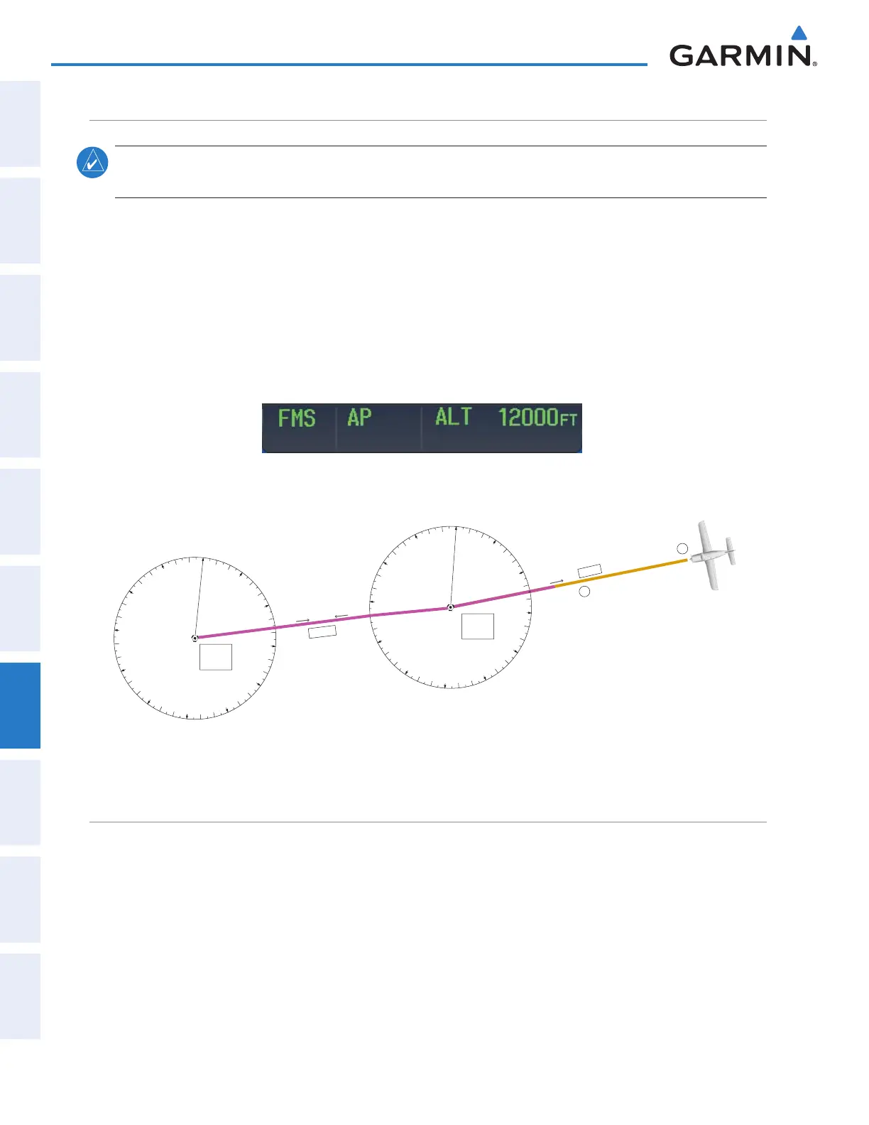
Flying A Flight plAn/FmS courSe
note: Changing the navigation source cancels Navigation Mode and causes the flight director to revert
back to Roll Hold Mode (wings rolled level).
As the aircraft closes on Salina VOR, FMS is used to navigate the next leg, airway V244. The aircraft is
currently tracking inbound on Airway V4.
Flying a FMS flight plan:
1) Transition from VOR to FMS Navigation Mode:
a) Press the
Active Nav
Softkey until FMS is the selected navigation source.
b) Press the
NAV
Key to activate FMS Navigation Mode. The autopilot guides the aircraft along the active flight
plan leg.
2) Following the flight plan, the autopilot continues to steer the aircraft under FMS guidance.
Figure 7-33 Transition to GPS Flight Plan
0
3
6
9
12
15
18
21
24
27
30
33
VOR NAV Mode
GPS NAV Mode
V 244
1
2
V 4
076
o
075
o
260
o
0
3
6
9
12
15
18
21
24
27
30
33
Salina
VOR
(SLN)
Hays
VOR
(HYS)
DeScent
While flying the arrival procedure, the aircraft is cleared for descent in preparation for the approach to KCOS.
Three methods are presented for descent:
• Flight Level Change descent – Flight Level Change Mode can be used to descend to the Selected Altitude at a
constant airspeed. This descent method does not account for flight plan waypoint altitude constraints.
• Vertical Path Tracking descent – Vertical Path Tracking Mode is used to follow the vertical descent path
defined in the FMS flight plan. Altitude constraints correspond to waypoints in the flight plan. Before VNAV
flight control can provide vertical profile guidance, a VNAV flight plan must be entered and enabled.
This manual downloaded from http://www.manualowl.com