Garmin G2000 Pilot’s Guide for the Cessna T240
190-01263-01 Rev. A188
Flight ManageMent
SYSteM
OVeRVieW
Flight
inStRUMentS
eiS
aUDiO Panel
& CnS
Flight
ManageMent
haZaRD
aVOiDanCe
aFCS
aDDitiOnal
FeatUReS
aPPenDiCeSinDeX
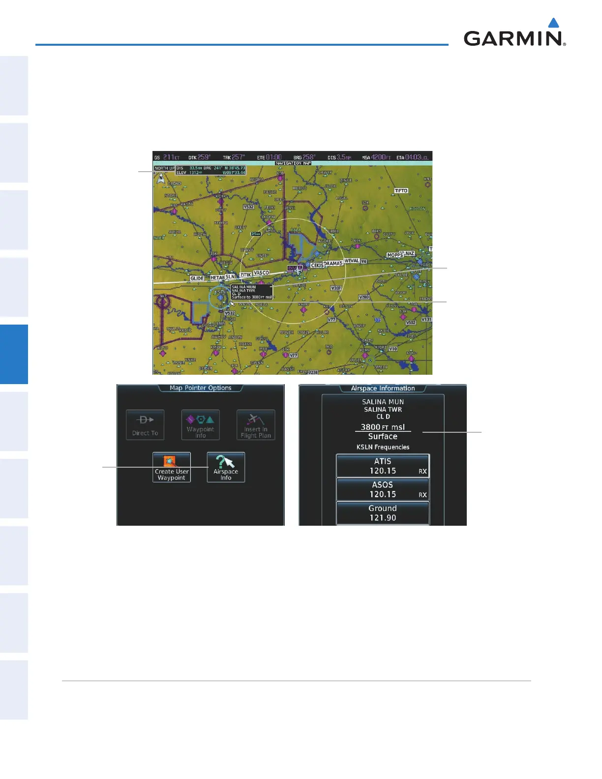
When the Map Pointer is on an airspace boundary, the boundary is highlighted and airspace information is
shown in a box above and to the right of the Map Pointer. The information includes the name and class of
airspace, the ceiling in feet above Mean Sea Level (MSL), and the floor in feet MSL. When an airspace is selected
on the map display, additional frequency information is also available by pressing the Airspace Info Button on
the Touchscreen Controller.
Airspace
Information
Airspace
Info
Button
Figure 5-13 Navigation Map - Map Pointer on Airspace
Map Pointer
on Airspace
Map Pointer
Information
Airspace
Information
Reviewing information for a special use or controlled airspace:
1) Place the Map Pointer on a waypoint.
2) Touch the Airspace Info Button to display the Airspace Information Screen.
3) Press the Joystick to exit the Airspace Information Screen and remove the Map Pointer from the Navigation
Map.
This manual downloaded from http://www.manualowl.com