190-01263-01 Rev. A
Garmin G2000 Pilot’s Guide for the Cessna T240
371
Hazard avoidance
SYSTeM
overvieW
FLiGHT
inSTrUMenTS
eiS aUdio & cnS
FLiGHT
ManaGeMenT
Hazard
avoidance
aFcS
addiTionaL
FeaTUreS
aPPendiceS indeX
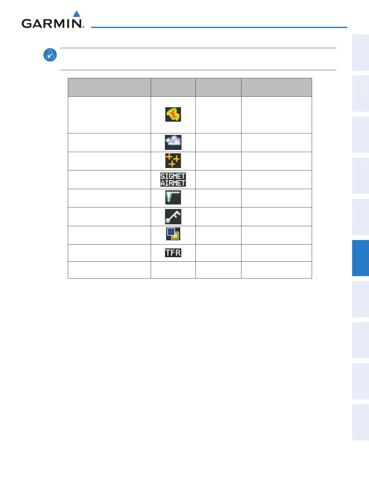
NOTE: The availability of specific Garmin Connext Weather products varies by region and by subscription type.
For Garmin Connext weather product coverage information, refer to fly.garmin.com/fly-garmin/gfds-weather.
Garmin Connext Weather
Product
Symbol
Expiration Time
(Minutes)
Refresh Rate
(Minutes)
Radar Precipitation
(PRECIP)
30
U.S.: 3*
Canada: 3*
†
Europe: 15
Australia: 15ˆ
Infrared Satellite
(IR SAT)
60 30
Data Link Lightning
(DL LTNG)
30 Continuous
SIGMETs/AIRMETs
(SIG/AIR)
60 Continuous
Meteorological Aerodrome Report
(METARs)
90 Continuous
Winds Aloft
(WIND)
60 Continuous
Pilot Weather Report
(PIREPs)
90 Continuous
Temporary Flight Restrictions
(TFRs)
60 Continuous
Terminal Aerodrome Reports
(TAFs)
no product image 60 Continuous
* The composite precipitation image is updated every 3 minutes, but individual radar sites may take
between 3 and 10 minutes to provide new data.
†
Canadian radar precipitation data provided by Environment Canada.
ˆ Australian radar precipitation data provided by the Australia Bureau of Meteorology
Table 6-5 Garmin Connext Weather Product Symbols and Data Timing
This manual downloaded from http://www.manualowl.com