Note: The BroadShield GNSS1 reference refers to the SecureSync
GNSS 0 reference.
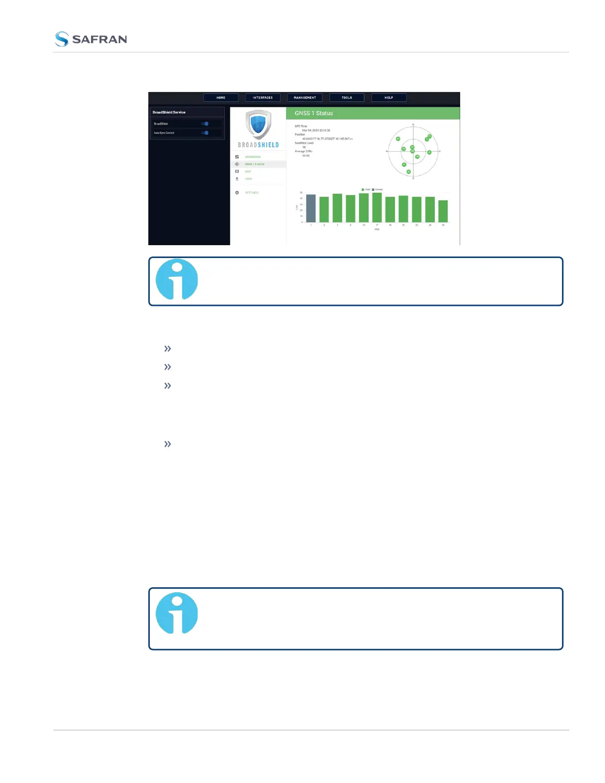
Status information
GPS Time: Time and Day as provided by VersaSync's GNSS receiver.
Position: The position as determined by VersaSync's GNSS receiver.
Satellites Used: The number of satellites currently received by VersaSync.
This number includes all satellites currently received for all enabled con-
stellations (see "Selecting GNSS Constellations" on page213). Note that
BroadShield uses only GPS signals for jamming/spoofing detection.
Average C/No: Average signal to noise ratio. An average C/No value higher
than 30 can be considered "good".
Skyplot graph
The center of the skyplot represents the antenna position. The skyplot shows all
GPS satellites currently being tracked and – if enabled (under INTERFACES:
REFERENCES > GNSS Reference: GNSS 0 > Edit button > Selected Con-
stellations) – will also display all GLONASS satellites (numbered 65 and higher).
Note, however, that GLONASS satellites will not be used by BroadShield. Galileo
and Beidou satellites will not be displayed.
Note: Even though VersaSync may be configured to track multiple
GNSS constellations (see "Selecting GNSS Constellations" on
page213), BroadShield only uses GPS.
3.3 Managing References
CHAPTER 3 • VersaSync User Manual Rev. 12
191