MD-11 Flight Crew Operations Manual
k
Instrumentation and Navigation -
Controls and Displays
Inst.30.4
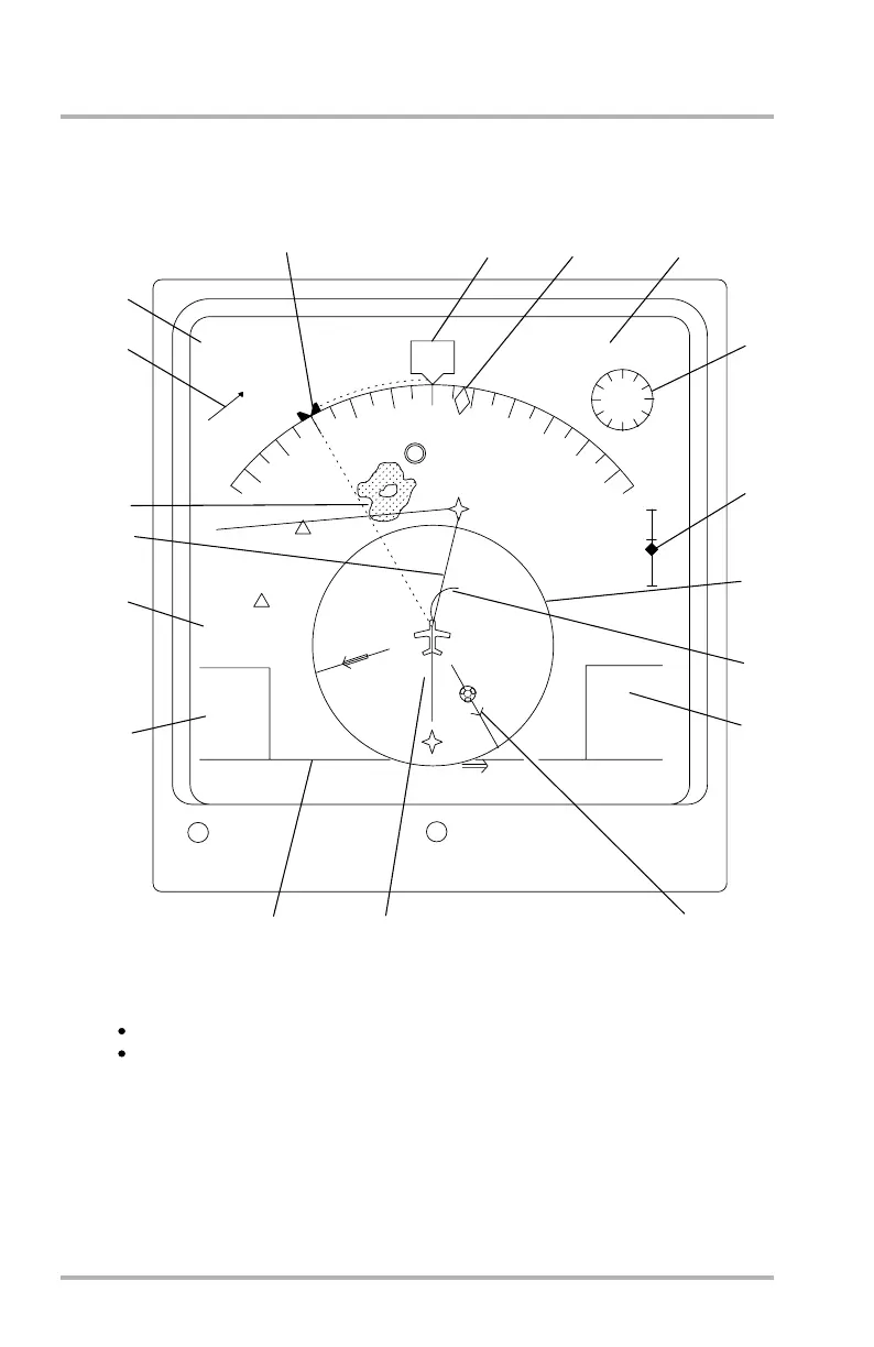
Navigation Display - Map Mode
LB1-3-0160
The map is referenced to the aircraft position and heading (or track).
It allows display of non-flight plan waypoints, airports, navaids, weather radar
data, and bearing pointers.
MAP
CDU MSG
DATA
CRL
TAS
HDG
MAG
GS
300
RW30 13 NM/0.5
TLT -3.5
195°/ 29.2NM
SXC
300
2
9
0
2
8
0
2
7
0
2
6
0
2
5
0
310
3
2
0
3
3
0
3
4
0
3
5
0
SLI
BECCA
5
VOR
WPT
NDB
ARPT
087°/
3.6NM
SLI
R/I
NAV
CPM
WILMA
FERMI
500
520
RNG 10
L0.1
11:55
00:15
1
2
3
4
5
6
7
8
9
10
11
12
13
14
15
The MAP mode is selected by pushing the MAP mode switch on the ECP. The MAP
mode has the following characteristics:
16
17
18
12/045
October 02, 2006