Width&Heightclearances
•Navionics®A
utoroutingandDock-to-dockdoesnotusetheuserdefined
Minimumsafewidthor
Minimumsafeheightsettingswhengeneratingroutes.Objectswithwidth/heightconstraints
aremark
edwithhazardwaypointsymbols,itiscriticalthattheselegsarecheckedtoensurethat
thereissufficientclearancetoavoidthehazard.
•C-MAP®EasyRoutingusestheuserdefined
Minimumsafewidthand Minimumsafeheight
settingstodetermineifsufficientclearanceisavailable
.Theusermustapplytheirownsafety
marginasappropriatetocurrentconditions.TheHeightdatummustbechecked,asitcouldbe
MeanHighWaterSprings(MHWS)orHighestAstronomicalTide(HAT).Inbothcasesthetidecan
behigherthanthedatumduetoatmosphericeffectssuchashighairpressure,winddirection,etc.
Reviewinganautomaticallygeneratedroute
Beforefollowinganyrouteyoumustensurethatitissafetodoso.
UponRoutecompletion:
1.RangeinoneachroutelegandwaypointthatmakeuptheRoute.
2.Checkeithersideoftheroutelegandaroundthewaypointforanypossibleobstructions.
Obstructionscanbechartedobjectsorrestrictedareas.Routesgeneratedautomaticallyshould
usethecautionwaypointsymbolinareaswheretherearepossibleobstructions.
3.Whereobstructionsexistmovethenecessarywaypointssothatthewaypointandroutelegis
nolongerobstructed.
Importingaroute
Y oucanimportroutescreatedinstandardgpxformat.
1.Saveyourroutetoamemorycard.
2.InsertthememorycardintoyourMFD.
3.SelectImportfromcardfromtheImport/exportpage: Homescreen>Mydata>Import/export
>Importfromcard.
4.LocateandselectthegpxfilethatcontainsyourRoute.
TheRoutewillbeimportedtoyourMFD.
Routemanagement
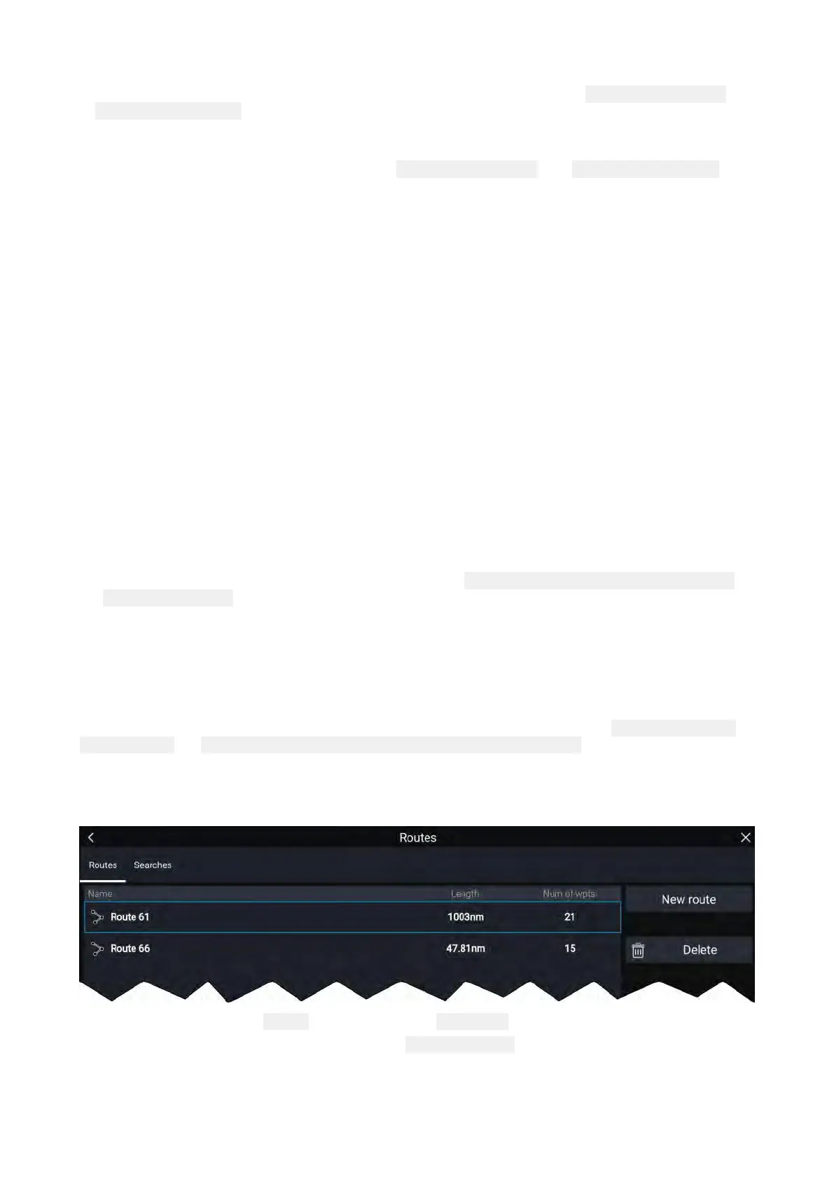
RoutesaremanagedusingtheRoutelist.
TheRoutelistcanbeaccessedfromtheHomescreenandfromtheChartapp:
Homescreen>My
data>R outes,or Chartapp>Menu>Waypoints,routes,tracks>Routes.
IftheRoutelistisaccessedfromtheChartappmenu,thentheselectedrouteisdisplayedina
Chartpaneontherightofthescreen.
Routelist
Fromtheroutelistyoucan Deleteroutesorcreatea Newrouteusingexistingwaypoints.
Toviewarouteplan,selectarouteandchoose Viewrouteplan.
Routeplan
TherouteplandisplaysalistofallwaypointsintherouteandwhenaccessedfromtheChartapp
alsoincludesaChartpaneshowingtheroute’slocation.
W aypoints,RoutesandT racks
117
 Loading...
