4.EGNOS(Europe)
5.G
AGAN(India)
6.KAAS(Korea)
7.MSAS(Japan)
8.NSAS(Nigeria)
9.SDCM(Russia)
10.WAAS(USA)
11.QZSS(JAPAN)
GNSS(GPS)Status
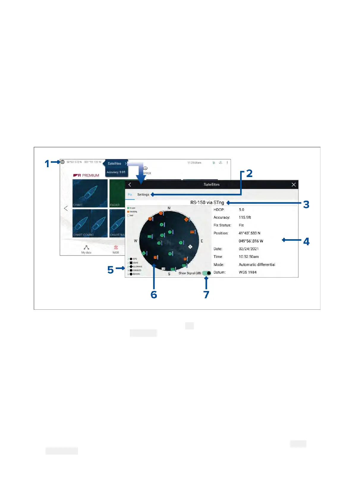
Y ourvessel’sGNSS(GPS)positionisprovidedinthetopleftcorneroftheHomescreen.Thestatusof
thepositionfixandthesatellitesinuseisdisplayedintheFixmenu.
1.IflatitudeandlongitudeisdisplayedontheHomescreen,youhaveavalidpositionfix.Ifthete xt
turnsred,yourfixaccuracyislow.T oaccessthe FixmenuselectthePositiondetailsareaonthe
Homescreenandthenselect
SatellitesfromthePop-overmenu.
2.SelecttoaccesssettingsrelatedtotheGNSS(GPS)receiver.
3.ThenameoftheGNSS(GPS)receivercurrentlybeingusedtoprovidepositiondatatothesystem
isdisplayedcenteredatthetopofthescreen.
4.Positionfixandfixaccuracydataisdisplayed..
5.TheshapeofthesatellitesymbolsidentifywhichGNSSconstellationtheybelongto.
6.Theskyviewontheleftsideofthepageshowsthepositionofnavigationsatellites.Thecolor
ofthesatelliteidentifiesitsstatus:
•Green=satelliteinuse
•Orange=trackingsatellite(notcurrentlyusedforpositionfix)
•Gray=searchingforsatellites
7.Thesignalstrengthindicatorforthesatellitescanbeenabledanddisabledusingthe
Show
Signal(dB)toggleswitch.
70

 Loading...