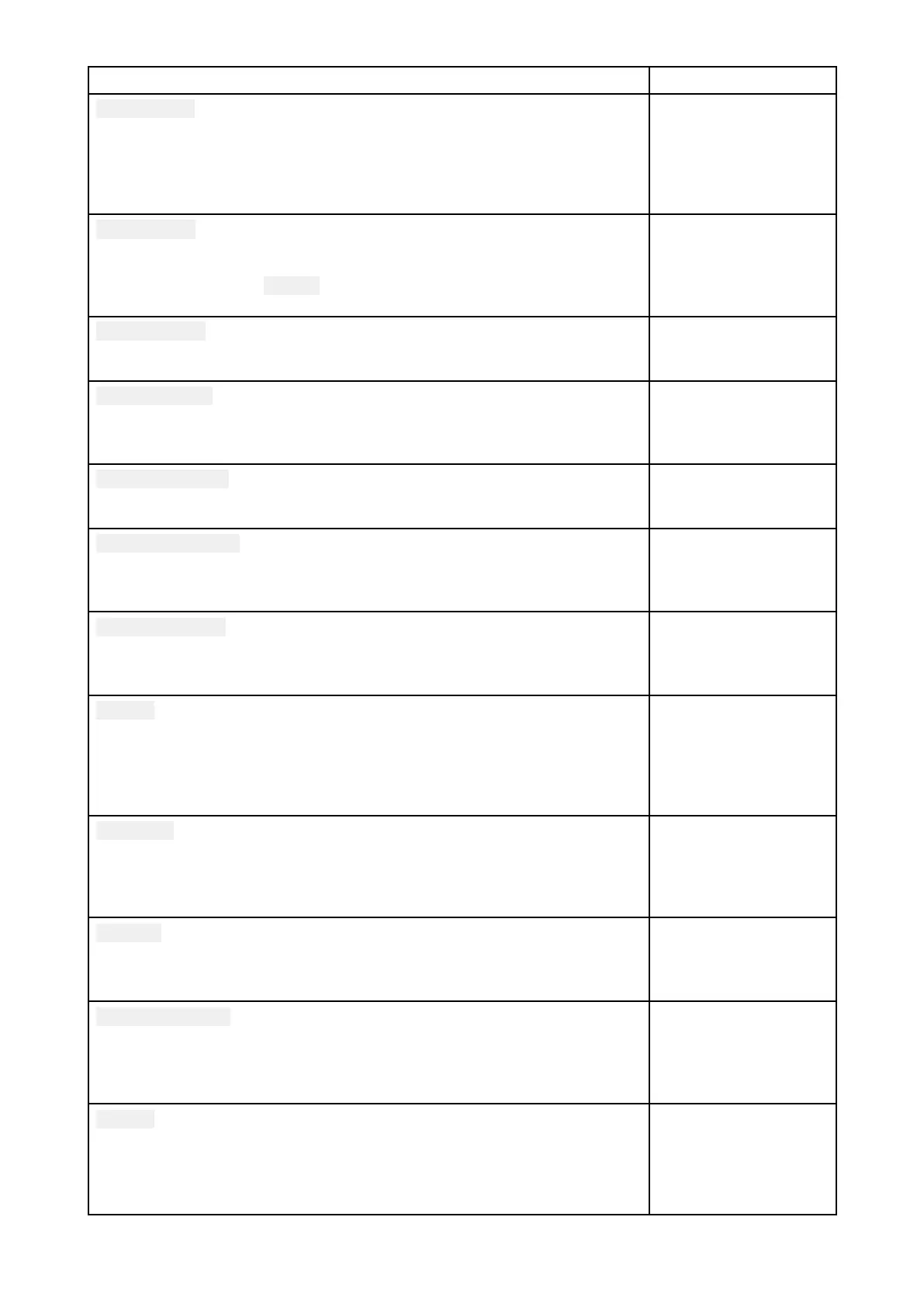
MenuitemanddescriptionOptions
Safecontour
DeterminesthedepthatwhichtheSafecontourisdisplayed.
TheSafecontourcannotbesettoavaluethatislessthantheShallow
contourorgreaterthantheDeepcontour
.
ThissettingisavailablewhenusingLightHouse™,legacyLightHouse™and
S-63vectorscharts.
Numericdepthvalue
Shallowarea
Enablesanddisablesidentificationofareasdeemedtobeshallow
.When
enabled,aredhatchedareaisdisplayedinareasshallowerthanthe
depthspecifiedinthe
Zerotofield.
ThissettingisavailablewhenusingNavionics®charts.
•On
•Off
Deepcontour:
Determinesthedepthatwhichthedeepcontour .
ThissettingisnotavailableforRastercharts
Numericdepthvalue
Depthgradient
Allowsyoutospecifythegradientshadebetweenshallowanddeep .
ThissettingisavailablewhenusingLightHouse™andlegacyLightHouse™
vectorcharts.
•Darktolight
•Lighttodark
Deepwatercolor
AllowsyoutospecifythecolorthatwillbeusedtodisplayDeepwater .
ThissettingisavailablewhenusingC-MAP®andNavionics®charts.
•White
•Blue
R ecorddepthdata
Enablesdepthandpositiondatatoberecordedtomemorycard.
ThissettingisavailablewhenusingLightHouse™andlegacyLightHouse™
vectorcharts.
•On
•Off
W aterlinetotdcr
Enterthedistancebetweenthewaterlineandyourdepthtransducer.
ThissettingisavailablewhenusingLightHouse™andlegacyLightHouse™
vectorcharts.
Numericdepthvalue
Saveto
WhenasuitableMicroSDcardhasbeeninsertedthefreespaceavailable
forrecordingdepthdataandR ealBathyisdisplayed.
ThissettingisavailablewhenusingLightHouse™andlegacyLightHouse™
vectorcharts.
.
•SD1
•SD2
R ealBathy
DisplayspreviouslyrecordedRealBathy™datasavedonmemorycard
onthechart.
ThissettingisavailablewhenusingLightHouse™andlegacyLightHouse™
vectorcharts.
•On
•Off
Visibility
DeterminesthetransparencyoftheR ealBathydatadisplayedonscreen.
ThissettingisavailablewhenusingLightHouse™andlegacyLightHouse™
vectorcharts.
•0%to100%
Heightcorrection
DeterminesthelevelofheightcorrectionappliedtoR ealBathyanddepth
data.
ThissettingisavailablewhenusingLightHouse™andlegacyLightHouse™
vectorcharts.
•None
•Tidal
•Lakelevel
Density
Selectsthedensityofavailabledepthcontours.
ThissettingisavailablewhenusingLightHouse™andlegacyLightHouse™
vectorcharts.
•L ow
•Medium
•High
•Veryhigh
Chartapp
201
 Loading...
