10
.1Weathermode
WeathermodeisavailableintheChartappifyouhaveaweatherreceiverandvalidsubscription.
SwitchingtheChartapptoweathermodeallowsyoutooverlayweatherdataandinformationfrom
yourweatherreceiver.
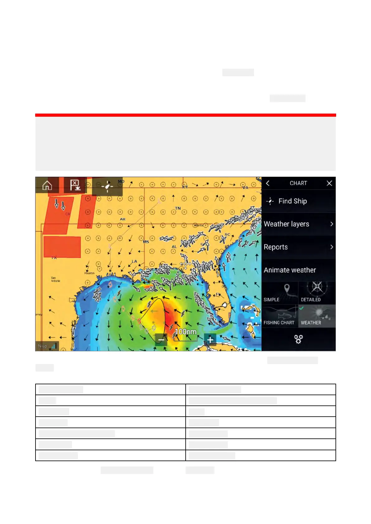
ToenterWeathermode,opentheChartappmenuandselect
WEA
THER.
Weathermodeallowsyoutotrackweathersystemsinrelationtoyourvesselbyoverlayinglive,
historicalandforecastedweatherdatadirectlyonthechart.InWeathermodeyoucanalsoview
animatedweathergraphicsandreadweatherreports.Weathermodesetsthe
Chartdetailsettingto
L
owandhidesotherdatawhichincreasesthevisibilityofWeatherdata.
Important:
•CompatiblehardwareandavalidsubscriptionisrequiredtoenableW eathermode.
•ByenablingWeathermodeyouagreetoitstermsofuse.
•DonotuseWeathermodefornavigation.
•WeatherdataisonlyavailableinNorthAmericaanditscoastalwaters.
W eathersymbolsareorganizedintolayers,accessiblefromtheChartmenu: Menu>Weather
layers.Eachlayercanbeenabledanddisabledindependently .
ThefollowingLayersareavailable:
W eatherradar
Surfacepressure
Cities Surfaceobservationstations
Cloudtop
Wind
Lightning
Watchbox
Seasurfacetemperature
Waveheight
S tormcast
Waveperiod
S tormtracks
Wavedirection
InW eathermodethe Chartorientationisfixedin North-Up.
228

 Loading...