Gocator Line Profile Sensors: User Manual
Gocator Web Interface • 321
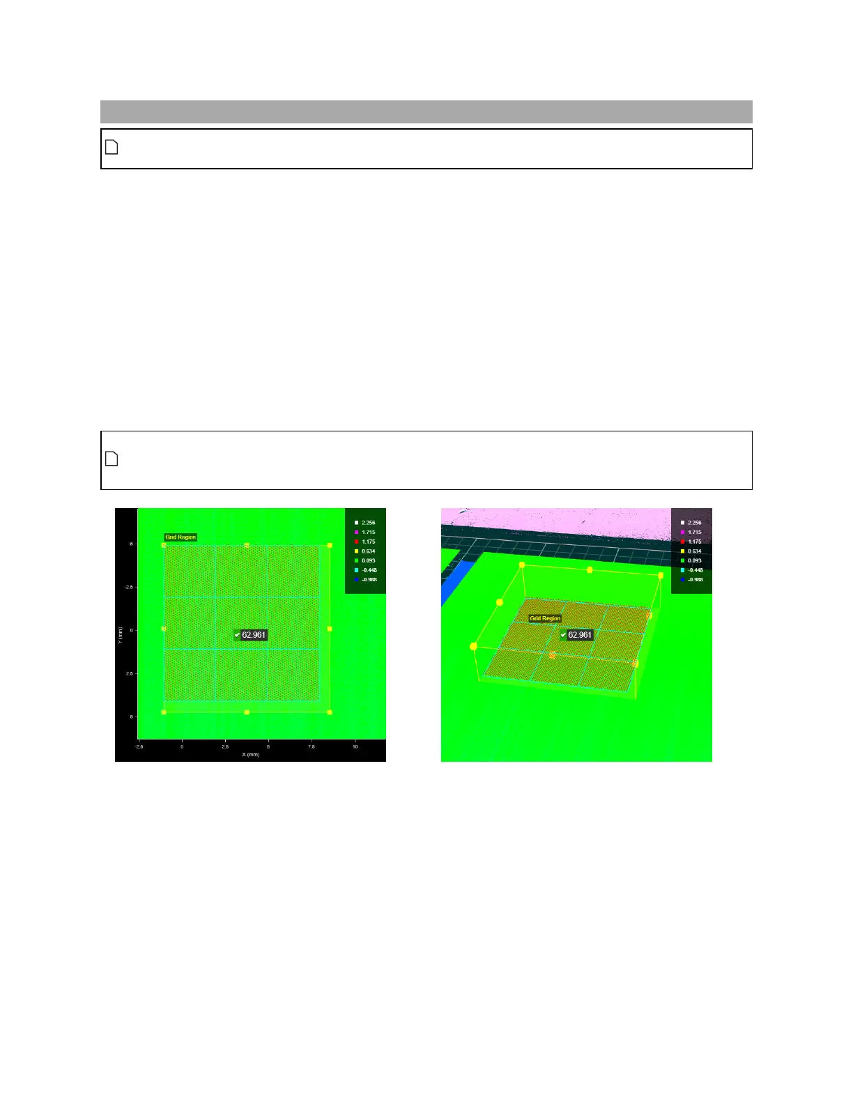
Flatness
This tool is not supported on A and B revision Gocator 2100 and 2300 sensors. It will however
appear in emulator scenarios created using these sensors.
The Flatness tool returns various measurements related to the flatness of one or more regionson the
surface of your target. The tool is ideal for general fit and finish inspection.
The tool lets you set a grid over a specific region, or more flexibly with multiple individual regions
manually. In each case, "local"minimum and maximum heights, as well as flatness indicators (maximum -
minimum), are returned (for grid cells or individual regions, depending on the tool's settings). In addition,
"global" minimum, maximum, and flatness measurements, that combine data from all flatness
measurement areas, can also be returned. The tool measures the maximum and minimum distances
from a different best-fit plane for each local measurement, and from another plane fit to all data for the
"global" measurements.
You can control how many data points the tool uses in its calculations to account for noise or smooth
data, or otherwise exclude unwanted data.
When you configure the tool to use a grid that contains more than 15 cells, only the first 15 local
measurements (which correspond to the first 15 cells of the grid) are displayed in the web
interface. Flatness results for cells beyond 15 are however available in the tool data.
2DView 3DView
 Loading...