737 Flight Crew Operations Manual
Flight Instruments, Displays -
PFD/ND – Displays
Boeing Proprietary. Copyright © Boeing. May be subject to export restrictions under EAR. See title page for details.
D6-27370-866-EGP 10.11.43
Vertical Situation Display (VSD) - Terrain Background
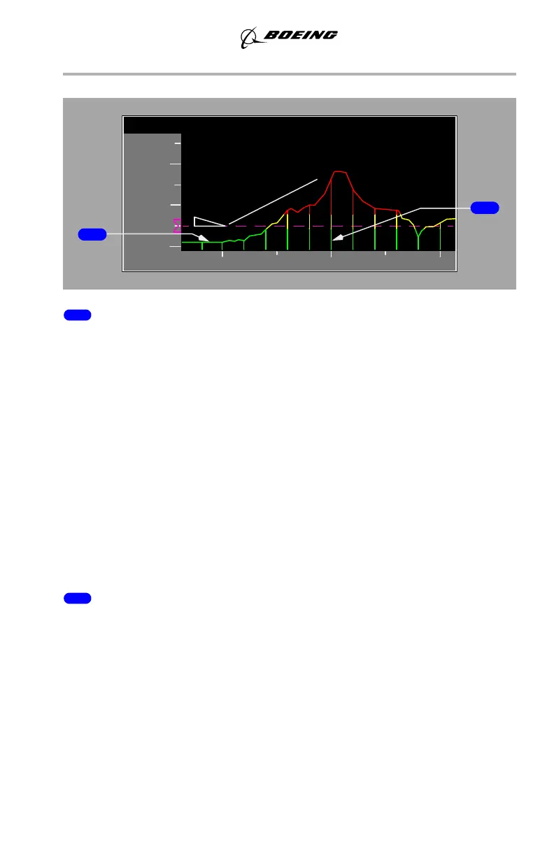
1 Terrain Profile Line
Represents the highest terrain within the enroute swath.
• highest points of the terrain below and ahead of the airplane
• terrain is depicted so the true altitude separation between the airplane
and terrain is shown
• terrain behind the airplane is drawn equal to the terrain at the current
position
• VSD terrain uses the same color coding that is used to depict EGPWS
terrain on the lateral map –
• green: terrain is more than 500 feet (250 feet gear down) below the
airplane
• amber: terrain ranges from 500 feet below (250 feet gear down) to 2000
feet above the airplane
• red: terrain is 2000 feet above the airplane.
Note: See Chapter 15, Section 10, for Terrain Warnings.
2 Vertical Support Lines
Vertical terrain vectors placed at constant intervals along the terrain profile line.
September 15, 2016