737 Flight Crew Operations Manual
Flight Instruments, Displays -
Electronic Flight Bag (EFB)
Boeing Proprietary. Copyright © Boeing. May be subject to export restrictions under EAR. See title page for details.
10.65.12 D6-27370-866-EGP
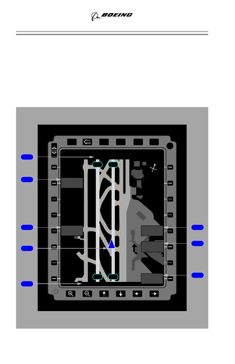
Airport Maps (Typical)
The maps are based on precise survey of airport geometry by satellite and other
means. There may be differences between the electronic airport map and the
airport diagrams that are part of the terminal charts, since these charts are derived
from different survey methods.
Airport Track Up (moving) Map
The airplane symbol remains stationary and the map moves to provide the location
and orientation of the airplane relative to the map.
XFRPGDNPGUP ENTER
DIM
BRT
PWR
MENU
B
Concourse
Concourse
C
North
Satellite
3.6 KM SEATTLE-TACOMA INT
M
L
N
J
C
C
Concourse
West
N
M
BA
SEARCH
APRT
KRNO
K
16L 16R
34L 34R
B
B
H
J
J
N
P
P
A
HIDE MENU
SHOW RNG
RING
NORTH-UP
MAP
AIRPORT MAP
TRK UP
KSEA MAG
E
W
S
N
September 15, 2016