PFD Operation
4-24 SkyView HDX Pilot’s User Guide – Revision B
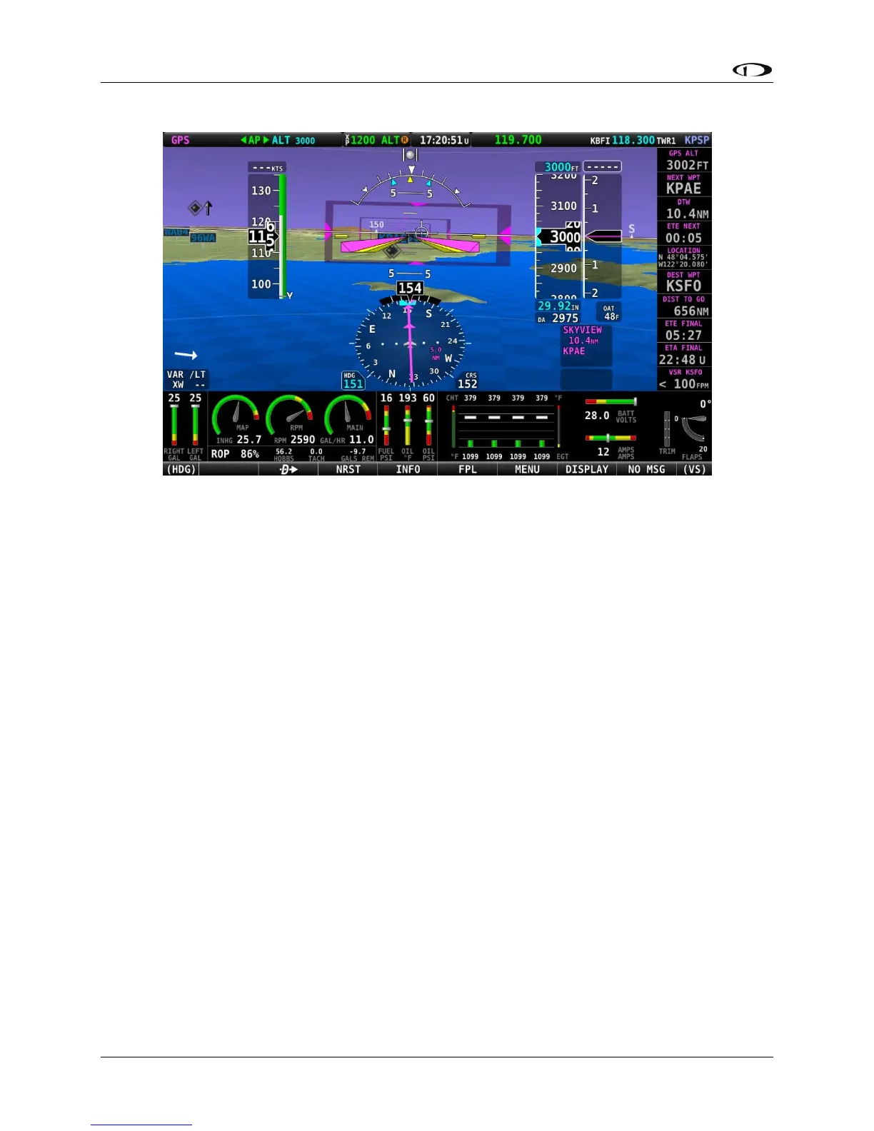
Figure 67 – Highway In the Sky (HITS)
Runways on Synthetic Vision
Runways are depicted at airports for which runway information is available in the US only. See
the Moving Map Operation section for more information about aviation data availability. Note
that in many cases, the information in the Synthetic Vision depictions of runways may not
match the actual markings of the physical runway. In fact, in many cases, the Synthetic Vision
depictions show more information about them. The following information is shown on
Synthetic Vision runways:
• Runway edge lines
• Runway centerline
• Runway numbers
• Runway thresholds / displaced thresholds
• Aiming point markings: two white strips drawn 1000’ after the threshold on runways
4000’ and longer
• Runway width threshold markings: drawn immediately after the runway threshold,
these groups of parallel lines visually indicate the width of the runway in the following
manner according to runway width:
o 0’-59’ wide: no lines
o 60’-74’ wide: 4 lines
o 75’-99’ wide: 6 lines
o 100’-149’ wide: 8 lines
o 150’-199’: 10 lines