737 Flight Crew Operations Manual
Flight Instruments, Displays -
PFD/ND – Navigation Displays
Boeing Proprietary. Copyright © Boeing. May be subject to export restrictions under EAR. See title page for details.
D6-27370-866-EGP 10.41.9
YW273, YW274
SYMBOL NAME MODE REMARKS
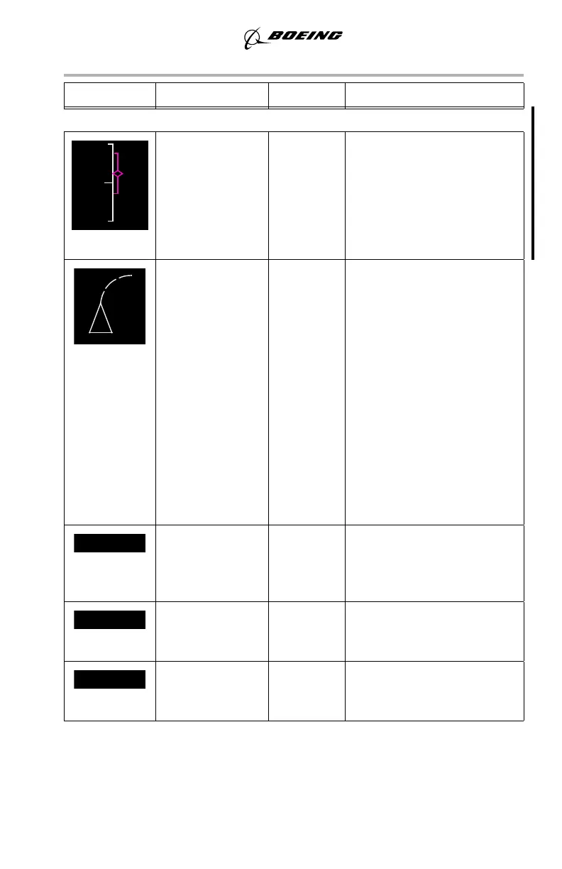
Path deviation
band (M),
Vertical
ANP/RNP values
(G)
MAP,
MAP CTR
Path deviation band is
symmetric about the pointer
and represents vertical RNP.
Whenever ANP exceeds
RNP, the ANP/RNP labels
and values are displayed in
amber.
Position trend
vector (W)
(dashed line)
MAP,
MAP CTR
Predicts position at the end of
30, 60, and 90 second
intervals. Each segment
represents 30 seconds. Based
on bank angle and ground
speed. Selected range
determines the number of
segments displayed. For
range:
• > 20 NM, 3
segments
• = 20 NM, 2
segments
• < = 10 NM, 1
segment.
Active waypoint
identifier (M)
MAP,
MAP CTR,
PLN
Indicates the active flight
plan waypoint, the next
waypoint on the route of
flight.
Active waypoint
distance (W)
MAP,
MAP CTR,
PLN
Distance to the active
waypoint.
Active waypoint
ETA (W)
MAP,
MAP CTR,
PLN
Indicates FMS–calculated
ETA at the active waypoint.
September 15, 2016