737 Flight Crew Operations Manual
Flight Instruments, Displays -
PFD/ND – Navigation Displays
Boeing Proprietary. Copyright © Boeing. May be subject to export restrictions under EAR. See title page for details.
D6-27370-866-EGP 10.41.13
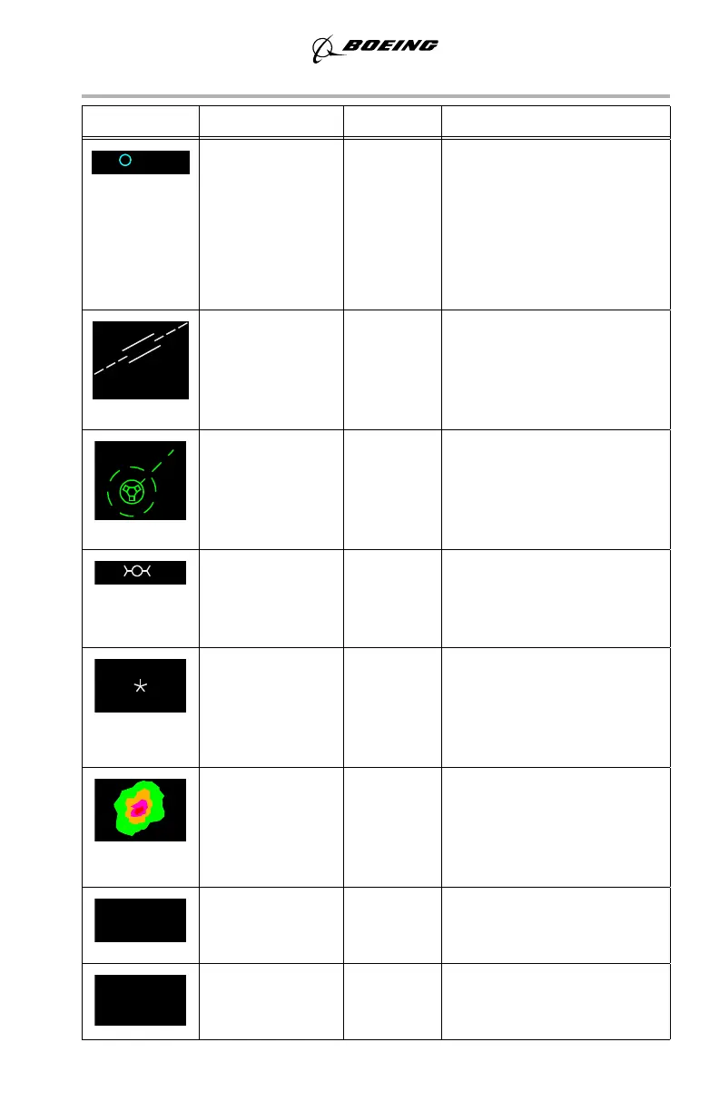
SYMBOL NAME MODE REMARKS
Airport (C) MAP,
MAP CTR,
PLN
Displayed if the EFIS control
panel ARPT map switch is
selected on.
Origin and destination
airports are always displayed,
regardless of map switch
selection.
Airport and
runway (W)
MAP,
MAP CTR,
PLN
Displayed when selected as
the origin or destination and
selected range is 5, 10, 20, or
40 NM. Dashed runway
centerlines extend 14.2 NM.
Selected
reference point
and bearing
distance
information (G)
MAP,
MAP CTR,
PLN
Displays the reference point
selected on the CDU FIX
page. Bearing and/or distance
from the fix are displayed
with dashes (G).
GPS position (W) MAP,
MAP CTR
When the EFIS POS map
switch is selected on,
indicates GPS position
relative to FMC position.
ADIRU position
(W)
MAP,
MAP CTR
When the EFIS control panel
POS map switch is selected
on, the star indicates ADIRU
position relative to FMC
position.
Weather radar
returns (R, A, G,
M)
MAP,
MAP CTR,
VOR,
APP
The most intense areas are
displayed in red, lesser
intensity in amber, and lowest
intensity green. Turbulence is
displayed in magenta.
Selected map
options (C)
MAP,
MAP CTR,
PLN
Displays EFIS control panel
selected map options.
MAP source
annunciation (G)
MAP,
MAP CTR,
PLN
Displays source of FMC data
used by CDS for data
presentation.
March 27, 2014