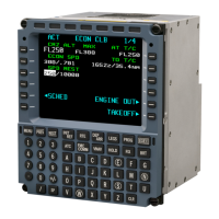
OPERATOR’S MANUAL
CMA-9000 FLIGHT MANAGEMENT SYSTEM
2. To create a downtrack fix along the flight plan where the radial from the entered "fix" intersects, key in the
radial (e.g. 175) and press LSK 3L or LSK 4L. or:
3. To create a downtrack fix along the flight plan where the distance from the entered "fix" intersects, key in /,
distance (e.g. /80) and press LSK 3L or LSK 4L. or:
4. To create a downtrack fix along the flight plan where the aircraft will be directly abeam the entered "fix",
press <ABEAM> (LSK 5L).
The distance to go (DTG) and ETA to the intersection point are displayed. If the radial, distance or abeam fix
does not intercept the route ahead of the aircraft, or the intersection point does not lie within 500 nm of the
reference fix, then the advisory message "!INVALID INTERSECTION" is displayed. Figure 5-2 shows a typical
downtrack fix creation involving the radial, distance or abeam fix intercepting the route ahead of the aircraft.
The displayed reference of the bearing (radial) (e.g. true or magnetic North) is consistent with the other
navigation angles as described in the SETUP page in Section 3.
5. Line select the intersection to the scratchpad by pressing LSK 3L, LSK 4L, or LSK 5L.
The intersection is displayed as a Place Bearing/Distance in the scratchpad e.g. ANN216.3/60.2.
NOTE: When the FIX is a 7-character waypoint identifier, the intersection is displayed as a waypoint
coordinate.
6. Display the desired location in the route by pressing [LEGS] and [NEXT] or [PREV] as required.
7. Move the waypoint to the desired place in the route by pressing the appropriate LSK.
8. Verify the waypoint entry and make the modified route active by pressing [EXEC].
NOTE: When no intersection is found with the active Flight Plan, the FIX INFO page will retain the radial or
distance entry.
If an ARINC 702 type EFIS is configured, it will display a green circle around the FIX waypoint. The
EFIS will display the radial as a line extending from the FIX. The distance is displayed as a circle with
its radius equal to the distance value entered.
ARINC 702 EFIS display capabilities may not support all of the features listed above. As a result, what
is actually displayed on the EFIS is installation dependent.
FIX INFO 1/1
FIX CRS/DIS REF
ANN 310
o
/ 456NM TO<
-- DOWNTRACK FIXES --
RAD/DIS DTG ETA
175
o
/ 80 NM 547NM 0307.2Z
163
o
/ 100NM 520NM 0239.2Z
ABEAM
216
o
/ 60NM 599NM 0400.6Z
<ERASE FIXES
ANN216.3
60.2
Page 5-21
August 17, 2010