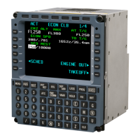
OPERATOR’S MANUAL
CMA-9000 FLIGHT MANAGEMENT SYSTEM
NAME SYMBOL APPLICABLE
MODE(S)
REMARKS
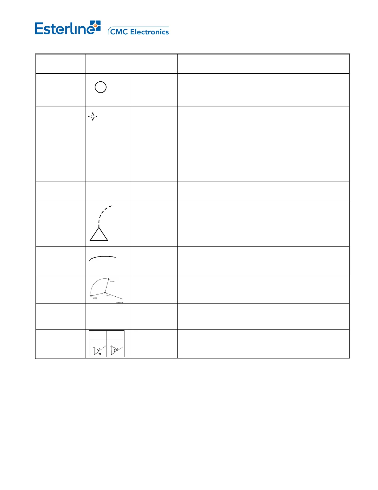
AIRPORT (C ) MAP
MAP CTR
When the ARPT P/B is ON, airports within the map area are
displayed. Origin and destination airports are always
displayed independent of ARPT P/B.
ROUTE DATA
(M, W
MAP
MAP CTR
PLAN
When the RTE DATA P/B is ON, altitude and ETA for route
waypoints can be displayed.
IRS POSITION
* (W)
MAP
MAP CTR
When POS P/B is ON indicates IRS position.
TREND
VECTOR (W)
MAP
MAP CTR
Predicts aircraft directional trend at the end of 30, 60 and 90
second intervals. Based on bank angle and ground speed.
3 segments are displayed when selected range is greater
than 20 nm, 2 segments are displayed on the 20 nm scale
and one segment on 10 nm scale.
ALTITUDE
RANGE
ARC (G)
MAP
MAP CTR
When intersected with the track line, it predicts the point
where the reference altitude will be reached, based on
current vertical speed.
DME ARC
MAP
MAP CTR
Predicts the track over the ground of an aircraft flying at a
constant distance from a navigational aid by reference to
distance measuring equipment (DME).
MAP SOURCE
ANNUNCIATIO
N (G)
FMS 1, 2 or 3 MAP
MAP CTR
Display EHSI source when alternate source is selected.
TURN
DIRECTION
(Ref True North)
Right
Left
MAP
MAP CTR
PLAN
Provide specific direction prior intercepting a flight path.
NOTE: Only applicable on installed systems that support a
Turn Direction symbol.
KTEB
KILMR
12000
0835Z
Page C-8
August 17, 2010