Gocator 2300 & 2880 Series
Gocator Web Interface • Scan Setup and Alignment • 116
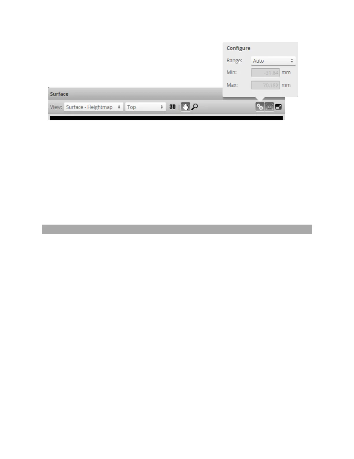
To change the scaling of the height map:
1. Select Heightmap from the drop-down in the data viewer.
2. Click the Scaling button.
l
To automatically set the scale, choose Auto in the Range drop-down.
l
To automatically set the scale based on a user-selected sub-region of the heightmap, choose Auto
- Region in the Range drop-down and adjust the yellow region box in the data viewer to the desired
location and size.
l
To manually set the scale, choose the Manual in the Range drop-down and enter the minimum
and maximum height to which the colors will be mapped.
Region Definition
Regions, such as an active area or a measurement region, can be graphically set up using the data viewer.
When the Scan page is active, the data viewer can be used to graphically configure the active area. The
Active Area setting can also be configured manually by entering values into its fields and is found in the
Sensor panel see on page 80.
 Loading...