5. ROUTES
5-2
5.2 How to Create a Route
5.2.1 How to create a route by selecting positions
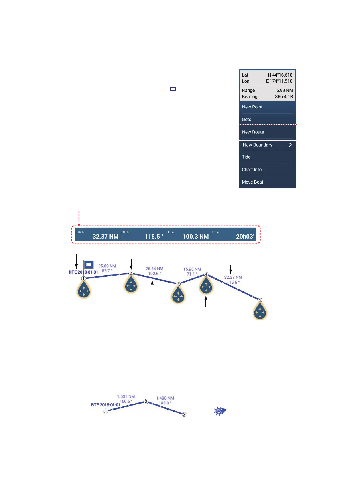
1. On the chart plotter screen, tap the location for the 1st
point in the route to display the pop-up menu.
2. Tap [New Route]. The flag mark ( ) appears on the se-
lected position and the route information box appears (at
the top of the screen).
3. Tap the next route point in the route. A light-blue line with
arrow runs between the previous route point and the next
route point. The arrow points in the direction of route
flow.
4. Tap the next route point in the route.
Repeat this step to enter all route points. The route infor-
mation box shows the point’s range and bearing, the dis-
tance to final destination, and the time-to-go to the last
point.
5. At the last route point, tap [End Route] at the top right-hand corner of the screen
to complete the route.
6. The window for entering route name appears. Enter route name, then tap [9] to
confirm. The route information box shows, to the last waypoint, the range, time-to-
go, estimated time of arrival, and SOG.
Note 1: The route created above is called an "inactive route". When you create a new
route or tap another route, that route becomes a "sleeping route".
Note 2: The points used to create a route by the above method are not saved to the
[Points] list.
Route name
1st route point
(starting point)
Route leg
Route point (The number
indicates the order of entry.)
Drag and drop to change
location of point
Distance and bearing
between two points
Navigation bar
- RNG: Range between last two points
- BRG: Bearing between last two points
- DTA: Distance to arrival
- TTA: Time to arrival
RTE 2018-01-01
Inactive route
Sleeping route
 Loading...