5. ROUTES
5-21
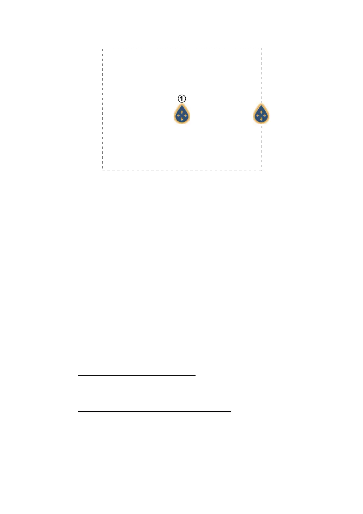
The screen shows the SAR and the SAR area, a dashed rectangle.
7. To change the search commence point, drag the icon marked with “1” in the figure
above.
8. If necessary, change the bearing search area. Drag the icon resting on the SAR
area, or tap the desired location on the screen.
9. Tap [End SAR] to finalize the SAR area.
10. Tap [OK] to start SAR operations.
If the NAVpilot-700 series is engaged and activated (see subsection 2.13.1) in the
system, the message "DO YOU WANT TO NAVIGATE USING THE NAVPILOT?"
appears. Tap [Yes] to have the NAVpilot steer the vessel, then the NAVpilot auto-
matically goes into the NAV mode. For the NAVpilot-300, you are asked to select
a navigation mode.
11. Select [Precision] or [Economy]. ([Cancel] stops the NAV mode.)
Precision: Keeps XTE within 0.01 NM
Economy: Keeps XTE within 0.03 NM
5.13 Fuel Level Indicators
This equipment provides indicators that show both the approximate location where
you may run out of fuel and the distance you can travel with the remaining fuel. This
function requires the NMEA 2000 sentence PGN127489 (Engine Fuel Rate).
Fuel max range indicator (on route)
The fuel pump icon marks on the current route how far you can travel on the remaining
fuel. To show this marker, tap [Settings]→[Routes]→[Fuel Max Range]→[ON].
Fuel range indicator (ring about own position)
The fuel range indicator draws a circle about own ship, the radius of the circle equiv-
alent to the distance you can travel with the remaining fuel. To show this indicator, tap
[Settings]→[Ship & Track]→[Fuel Range Ring]→[ON].
 Loading...