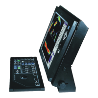
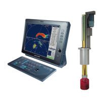
SimradSU90
Positioningsysteminterface
Astandardordifferentialglobalpositioningsystem(GPS)canbeconnectedtothe
SU90toindicatethelatitudeandlongitudepositionofthevessel,cursor,markersand
targets.Inadditiontothenavigationaldata,theGPSsystemmayalsobeusedforthe
inputofthespeedloginformation.MostGPSsystemsareequippedtopresentthe
courseinformation,butthisdataisgenerallytooinconsistenttoprovideastablesonar
presentation.ThesonarcanreadtheGPSdatafromaseriallinewithastandardNMEA
0183telegramformat.
ForphysicalconnectiontotheGPSunit,refertotheapplicableGPSdocumentation.
Echosoundersysteminterface
Toprovidedepthinformationonthesonar,anechosounderwithstandardNMEA0183
outputformat(serialline)maybeconnected.MostKongsbergMaritimeechosounders
havethedepthoutputavailableonaserialline.
ForconnectiontoaKongsbergMaritimeechosounderusingaserialline,referto
informationlistedbelow.Thisisa“one-way”connection,sincethesonardoesnot
outputanydatathatareusefulfortheechosounder.Forphysicalconnectiontoathird
partyechosounder,refertotheapplicableechosounderdocumentation.
Trawlsonarinterface
TheSimradSU90canreadthetrawldatafromaSimradFS20,FS25orFS70Trawl
sonarortheSimradITI(IntegratedTrawlInstrumentation)system.Thecommunication
isachievedusingaserialline.
WhenconnectingtheFSSeriesTrawlsonartothesonar,thetrawldepthwill
automaticallybeshowninaccordancewiththesurface,targetsandbottominthe
verticalmodesonthesonar.WhentheITItrawlsystemisconnectedtotheSU90,the
informationexchangedbetweentheITIandsonarare:
•ITItosonar:
–Trawlpositionrelativetovessel($IITPT)
–Depthoftrawlbelowsurface($IIDBS)
–Trawlheadropetofootropedistance(@IIHFB)
–Trawldoorspread(@IITDS)
–Trawllling(@IITFI)
–Watertemperatureattrawl($IIMTW)
•SonartoITI:
–Positionoftargetormarker(@SSTPP)
ForconnectiontoaFS20,FS25,FS70orITItrawlsystem,refertotheinformationlisted
below.Forphysicalconnectiontoathirdpartytrawlsystem,refertotheapplicabletrawl
systemdocumentation.
286
381293/A