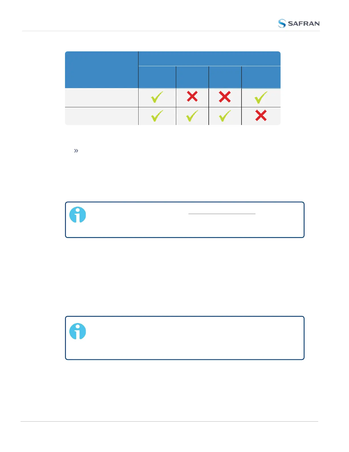
Receiver Mode
Receiver Dynamics
Land
(Resurvey)
Sea Air
Stationary
(No Resur-
vey)
Standard
Mobile (with u-blox receiv-
ers)
Notes:
The u-blox M8T receiver now uses Land to indicate it will RESURVEY on
reboot, and Stationary to indicate it will not resurvey after reboot.
3.3.3.5 Performing a GNSS Receiver Survey
Note: This topic only applies to stationary applications – in Mobile
receiver mode NO surveys will be carried out since the position is
updated continuously.
When SecureSync's integrated GNSS receiver performs a survey, it tries to
determine or verify its geographic position with high accuracy. An accurate geo-
graphic position is required to calculate a precise system time from the GNSS ref-
erence.
During a GNSS survey, the position will be iteratively recalculated while gradually
increasing the position accuracy. A survey can take up to 33minutes, but typ-
ically SecureSync will synchronize earlier, i.e. offer a valid Timeand 1PPS ref-
erence, once it has obtained a sufficiently accurate preliminary position.
Note: If a system has been moved, in Standard receiver mode and
Land Dynamics, receivers will automatically re-survey on reboot. In
Standard mode and Stationary Dynamics, the unit will survey only
once, and will not re-survey on reboot.
Verifying GNSS Survey Progress
236
CHAPTER 3 • SecureSync 2400 User Manual Rev. 5.2
3.3 Managing References