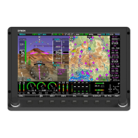
Navigation Mapping Setup
SkyView HDX System Installation Manual - Revision E 22-1
22 Navigation Mapping Setup
22.1 Features Overview
The following features are enabled as long as SkyView has a valid GPS position signal,
the appropriate high resolution terrain database installed for the region of the world that
you are flying in, and aviation database installed.
• Use of MAP menu and features, including:
o Display of airport, airspace, obstacles, traffic, and other aviation data that is
available (capabilities depend on available databases and other installed
equipment).
o Display of procedure charts, airport diagrams, enroute charts (sectionals),
and other layers that can be overlaid on the map.
o Display of base map features, including roads, city names, railroads, rivers,
and political boundaries.
o All Navigation Mapping features available via the MAP menu.
o Display of obstacles and runways on Synthetic Vision (if Synthetic Vision is
licensed).
o All future updates to the SV-MAP-270 Navigation Mapping License.
22.2 Databases
SkyView utilizes a variety of databases to display information on the moving map and
present options for navigation. These include:
• Charts: Scanned or electronic versions of procedure charts, airport diagrams,
and enroute charts. Seattle Avionics data available for US SkyView pilots.
PocketFMS, OzRunways, and AvPlan EFB data available for other worldwide
SkyView pilots.
• Aviation data: Airports, navigation aids, airspace, airport information, etc.
Available for free for US SkyView pilots from Dynon Avionics. Jeppesen and
PocketFMS data available for all other SkyView pilots worldwide.
• Obstacles data: Available for free for US SkyView pilots from Dynon Avionics.
Jeppesen and PocketFMS data available for all other SkyView pilots
worldwide.
• Terrain data: A high resolution terrain database is used to display the
topographic map. Available worldwide for free from Dynon Avionics.
• Base map (Cultural) data: Base map is available for free for all SkyView pilots
from Dynon Avionics worldwide.
• Stadium TFR data: Available for free for US SkyView pilots from Dynon
Avionics.