Navigation Mapping Setup
22-4 SkyView HDX System Installation Manual - Revision E
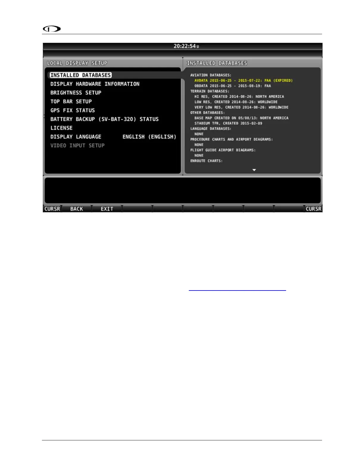
Figure 129: SkyView INSTALLED DATABASES with Expired Database Shown in Yellow
22.2.2 Terrain Database
SkyView uses high resolution terrain databases to display the base topographic map on
the MAP page, as well as to display Synthetic Vision on the PFD page. The Skyview HDX
displays are shipped with terrain databases for North America (includes the continental
United States, part of Alaska, most of Canada, Mexico, part of Central America, and the
West Indies). Dynon Avionics offers downloadable high resolution terrain database files
for other regions of the world on its website at http://www.dynoncertified.com.
To update the terrain databases in a SkyView display, download the appropriate file onto
a USB flash drive (a 4 GB drive is included with every SkyView display) and then
reference the How to Load and Delete Files Section of this manual for instructions on how
to import the file onto a SkyView display. Because the terrain databases are large, only
one (1) can be installed in a SkyView display at a time. A large USB flash drive can hold
multiple terrain databases for different regions of the world. However, each region’s
coverage area is chosen to cover most pilots’ needs without having to ever switch
between regions. Loading a new high resolution terrain database will automatically delete
the one (1) previously installed on your SkyView display.
If SkyView detects that it is in an area outside of the boundaries of the high resolution
terrain database currently installed on SkyView, a Caution message will be displayed: NO
HI-RES TERRAIN.
This occurs most often outside North America as SkyView is (typically) shipped from the
factory with a high resolution terrain database for North America. To correct this issue,
install the high resolution terrain database for your region.