Appendix E: Serial Data Output
25-4 SkyView System Installation Guide - Revision AA
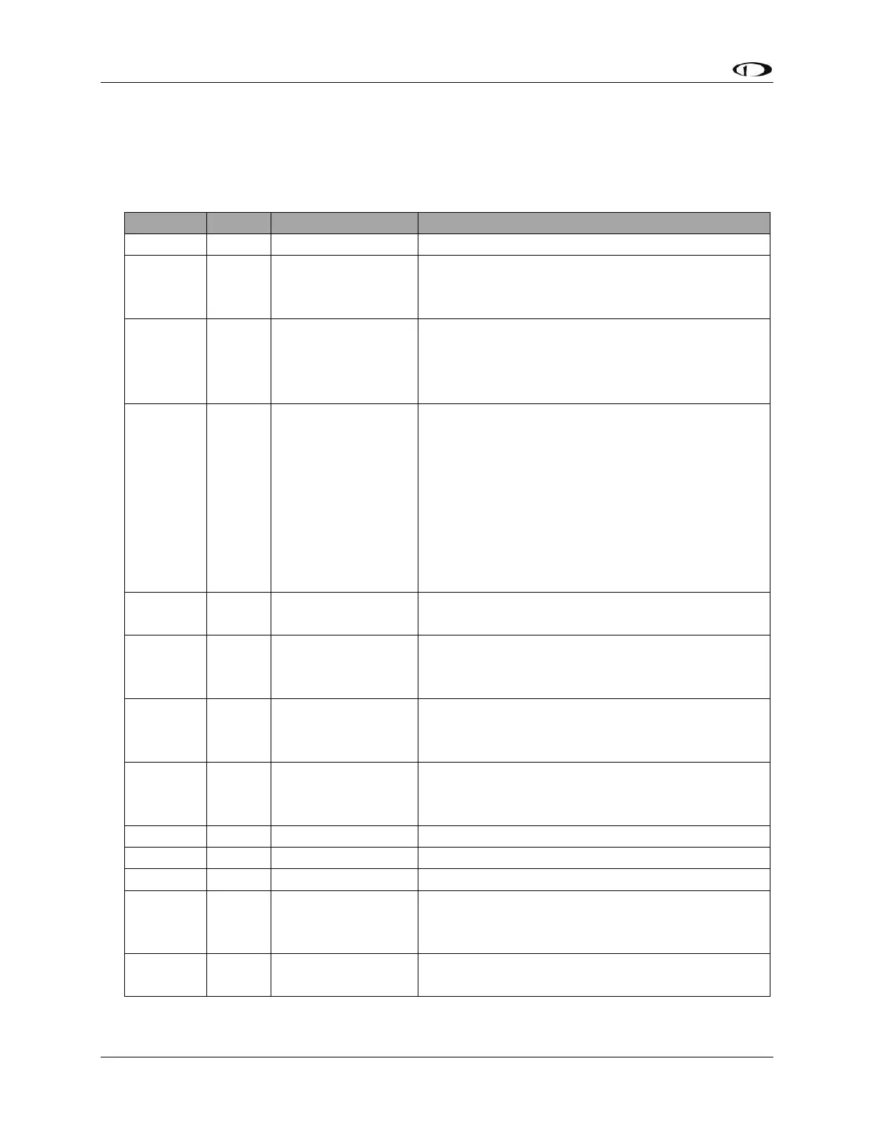
!1121144703-014+00003310811+01736+003-03+1013-033+110831245+01650023176C
DYNON SYSTEM Serial Data Format
The following section details the format of DYNON SYSTEM serial output data:
2 = System Info. Other Dynon Avionics formats
look similar, and may be interleaved, this bit
indicates what kind of data will follow.
Currently 2. This is the version of the data
represented below and will change if there is a
future version that changes data. Data version
changed at SkyView Software v5.1.
HHMMSSFF, current Zulu time according to
SkyView’s internal clock which is synchronized
with GPS time if GPS is available. HH is the hour
from 00 to 23. MM is the minute from 00 to 59.
SS is the second from 00 to 59. HHMMSS are ‘---
-----‘ if GPS time has never been available. FF is
the 1/16-second fraction counter from 00 to 15,
and may skip digits if baud rate is too low to
send data at 16Hz.
000 to 359 in degrees. XXX if heading bug is not
displayed.
+/- then 0000 to 9999, altitude in units of tens
of feet (1234 = 12,340 ft.). XXXXX if altitude bug
is not displayed.
0000 to 9999, airspeed in units of knots *
10 (1234 = 123.4 knots). XXXX if airspeed bug is
not displayed.
Vertical Speed Bug
(ft./min)
+/- then 000 to 999, tens of feet/minute. (123 =
1230 ft./min), positive meaning climb. XXXX if
vertical speed bug is not displayed.
0-2. 0=GPS, 1=NAV, 2=LOC.
0-5. GPSX, NAVX, or LOCX.
00-50. In tenths of NM, 50 = 5.0 NM. Output
‘XX’ when not in GPS mode as there is no scale
in NAV or LOC
+/- then 00 to 99 percent of deflection, +
meaning deflected to right, ‘XXX’ w/o valid CDI.