Document number changed to 101320-001.
Software changes in SkyView Software v1.5:
o Added: A basic moving map displaying aviation data within the United
States. This data is overlaid on the look down terrain, and shows airspaces,
airports, airport identifiers, and VOR's in relation to the current location of
the aircraft. To display this data, you must have an active GPS signal and the
USA aviation database installed.
There is not currently any user interface to this data, such as a cursor or any
menus, and there is no flight planning interface. These functions are
planned for a future release of software. Data is limited to the United States
for now and is provided by Dynon Avionics free of charge via our website.
The USA data is sourced from FAA's published data. Dynon Avionics is
working with other data providers to obtain data for regions outside of the
United States, and will support this as soon as is possible. There likely will
be a fee for non-US data.
o Added: All user calibrations and settings are propagated across the entire
SkyView system.
o Added: Various adjustments now propagate to all SkyView screens in the
system. This includes altimeter setting, bugs, screen dimming, message
acknowledgment, and other real-time adjustments.
o Added: GPS assist mode to ADAHRS algorithm. GPS ground speed is
automatically substituted for airspeed when the System detects that the
airspeed indication has failed (usually because of an iced, blocked, or
otherwise disconnected pitot). When this happens, the PFD annunciates
that its attitude indication is in a “GPS Assist” mode. The EFIS display also
shows GPS ground speed next to the failed airspeed indication to help the
pilot maintain situational awareness. Most importantly, when in GPS Assist
mode, the attitude provided by Dynon Avionics PFD continues to be
accurate.
o Added: GPS ground speed and GPS altitude text on the map screen.
o Fixed: Garmin 400/500 series panel-mount GPS data now correctly
interpreted. Fixes include lat/long reports and track that was incorrect by
degrees of magvar.
o Fixed: All pressure sensors correctly display 0 instead of being X'd out when
at 0 pressure.
o Fixed: Newer Honeywell Rotax-provided oil pressure sensor now works
correctly without an external 200-ohm resistor.
o Fixed: GPS position must include altitude to be valid for use in SkyView.
o Fixed: Grey code converter module now works consistently.
Minor style, grammar, and cross reference changes and corrections
Added servo installation information in various sections.
Clarified SV-ADAHRS-200/201 installation orientation requirements.
Clarified SkyView display basic operation procedures. Most notably, added a screen
synchronization section.
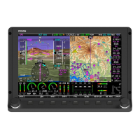
SV-D700 / SV-D1000 Installation and Configuration `:
o Recommended use of 5A fuse / circuit breaker instead of a 7.5A (Page 4-7).
o Added important SV-BAT-320 information (Page 4-7).
o Consolidated serial device installation into this section.
o Added installation information for external dimming control and audio
outputs.
o Expanded the Brightness Setup Section.
o Added a section regarding installed databases.
o Added a section reminding users outside of North America that they will
need to install an applicable terrain database file (Page 4-14).
o Added a section regarding Aviation Data.
Cautioned against the use of ferrous pneumatic fittings (Page 5-3).