5.
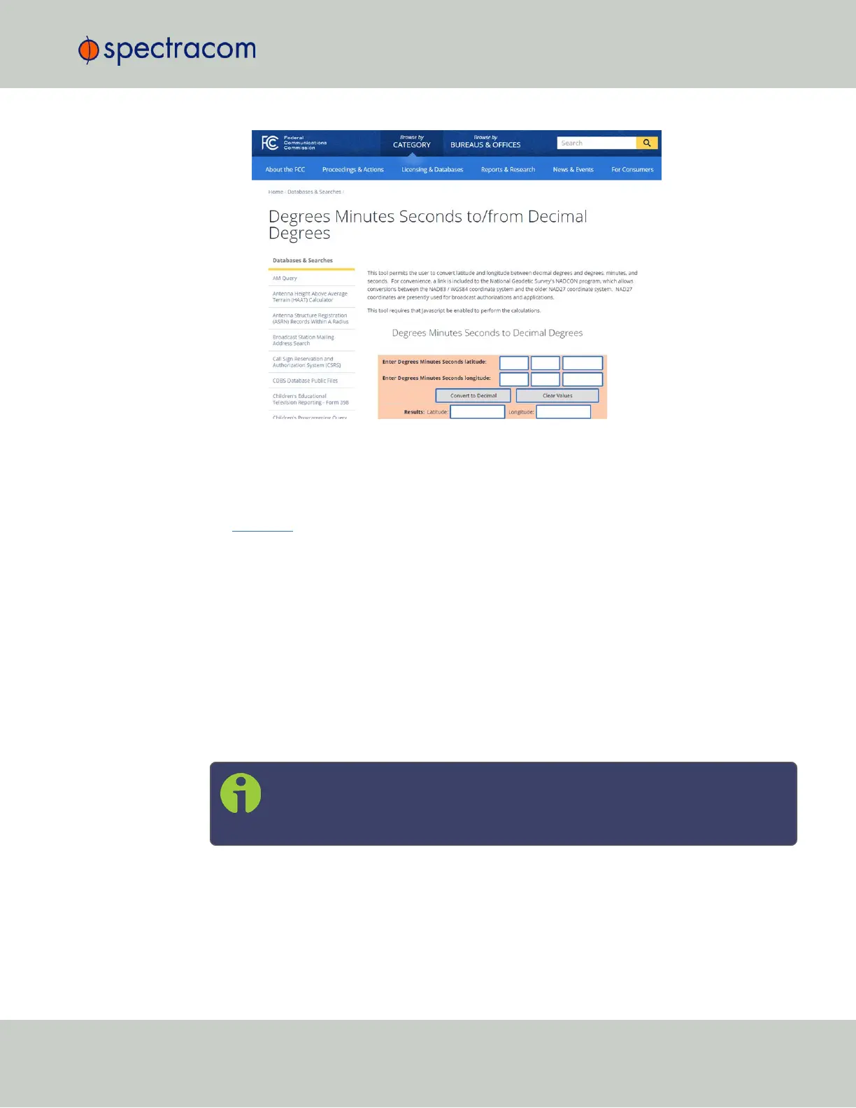
Determine your altitude: To find the elevation of your location, search online for a
Google Maps elevation finder
tool. Do not forget to add the height above ground for
your antenna.
If a more exact altitude is desired, the use of a topographical map is recommended. Applying
the WGS 84 standard will likely yield the most accurate elevation.
3.3.3.10 GNSS Constellations
Depending on the GNSS receiver installed in your unit (see "Determining Your GNSS Receiver
Model" on page187), SecureSync allows you to select which GNSS constellations can be
tracked. For example, you can determine if you want GLONASS satellites to be tracked
(besides GPS).
Selecting GNSS Constellations
If your SecureSync is equipped with a GNSS receiver other than a Res-T model, it is capable of
tracking multiple GNSS constellations simultaneously.
Note: As of System software version 5.7.0, the Multi GNSS Option is no longer
required to receive several constellations simultaneously. After an upgrade, the
previous constellation settings will be maintained.
To learn more about determining which receiver model is installed in your unit, and which
GNSS constellations and combinations are supported, see "Determining Your GNSS Receiver
Model" on page187.
3.3 Managing References
CHAPTER 3 • SecureSync User Reference Guide Rev. 26
201