406273/C
57
Echogramviews
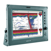
TheES80supportsseveraldifferentechogramtypes.Eachechogramisshownina
separateviewintheES80presentation.ThetabsatthebottomoftheES80presentation
allowsyoutochoosewhichchannelstoopen.
Supportedechogramtypes
•Surface
ASurfaceechogramismainlyusedwhenyouwishtolookattheentirewater
columnstartingfromtheseasurfaceanddowntothebottom.Sincethisechogram
isreferencedtotheseasurface,thebottomcontourwillvarywiththeactualdepth.
IfyousetuptheStartRangeandRangedepthstoplacethebottomcontouratthe
lowerendoftheechogram,youwillhavegoodopportunitytostudytheechoesfrom
thewatercolumn.
Surfaceechogramdescription,page257
•Bottom
ABottomechogramismainlyusedwhenyouwishtoexaminetheechoesfromsh
closetothebottom.Sincethisechogramisreferencedtothebottom,theseasurface
willvarywiththeactualdepth,whilethebottomisdrawnat.Thismakesiteasy
tostudytheechoesfromthebottom.Youcaninvestigatethebottomconditionsand
hardness,anddetectsh.
Bottomechogramdescription,page260
•Pelagic
APelagicechogramismainlyusedwhenyouwishtolookatthewatercolumn
startingfromanydistancebelowtheseasurfacedowntowardsthebottom,but
withoutseeingthebottomcontour.Pelagicechogramsareusefulwhenyouworkin
deeperwaters.Thereducedrangeandthefactthatyoudonotneedtowaitforthe
bottomechomeansthattheES80'spingrateisincreased.
Pelagicechogramdescription,page263
•Trawl
Trawlsensorsystems(suchasSimradPI,PXandITI)communicateheadropedepth,
and/orthedistancefromtheheadropetothefootrope(trawlopening),totheES80at
regularintervals.Thisinformationisrequiredforthetrawlechogramtobegenerated.
TheTrawlechogramcoverstheverticalopeningofthetrawlwithreferencetothe
depthoftheheadrope.Inadditiontothetrawlopening,theechogramcoversacertain
rangeoverandunderthetrawlopening.
Trawlechogramdescription,page265
Selectingwhichechogramtypetouse
Onceoneormoreechogramviewsareopen,youcan
choosewhichechogramtypetosee.
Clickonceintheechogramviewthatyouwishtochange.Thiswillmaketheview
"active".Athickborderisplacedontheselectedviewtovisualizethis.Openthe
Gettingstarted