EasyManuals Logo

Codan Envoy Reference Manual

Codan Envoy
537 pages
To Next Page IconTo Next Page
To Previous Page IconTo Previous Page
Page #98 background imageLoading...
Page #98 background image
OPERATING THE TRANSCEIVER
USING GPS
76 E
NVOY™ TRANSCEIVER REFERENCE MANUAL
1 Press (Close).
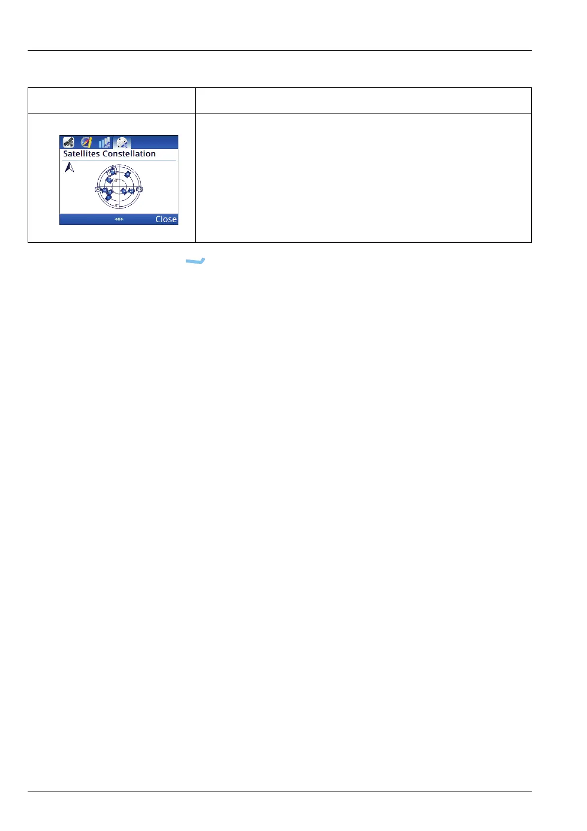
Map of visible satellites. The satellites that are coloured blue
provide the strongest signals and this information is used to establish
the position of the receiver. The other satellites are visible, but the
signal is weaker and information is ignored.
Table 2: GPS information (cont.)
Tab Description

Table of Contents

Other manuals for Codan Envoy

Questions and Answers:

Question and Answer IconNeed help?

Do you have a question about the Codan Envoy and is the answer not in the manual?

Codan Envoy Specifications

General IconGeneral
BrandCodan
ModelEnvoy
CategoryTransceiver
LanguageEnglish

Related product manuals