DGPS TEEJET 5000 OPERATORS MANUAL
9.4
DGPS STATUS
DG
eller
G
”DG” is displayed when satellite and reference
signals are being received.
If positional signals are only being received from
satellites then ”G” will be displayed.
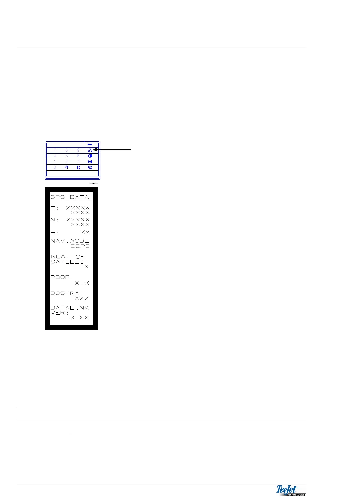
Pressing the STATUS key on the TeeJet 5000
displays the present DGPS Status
E: Latitude. The position is shown in
degrees, minutes and ten
thousandths of a minute.
N: Longitude. The position is shown in
degrees, minutes and ten
thousandths of a minute.
H: Altitude. The height in metres from
sea level.
NAV. MODE: Tells the operator whether there is
only signals from satellites (GPS) or
if reference signals are also being
received. (DGPS).
NO. OF
SATELLITES: The number of satellites that
signals are being received from.
PDOP: The distance between the satellites
that signals are being received
from.
DOSERATE: The application rate decided by the
application map.
IMPORTANT
Before the data card is removed from the DataLink module after
executing any of the following DGPS functions, press the
“RETURN” key until the main DGPS menu is displayed and
switch the power off to the DataLink module.