Services Location information
IX20 User Guide
722
n
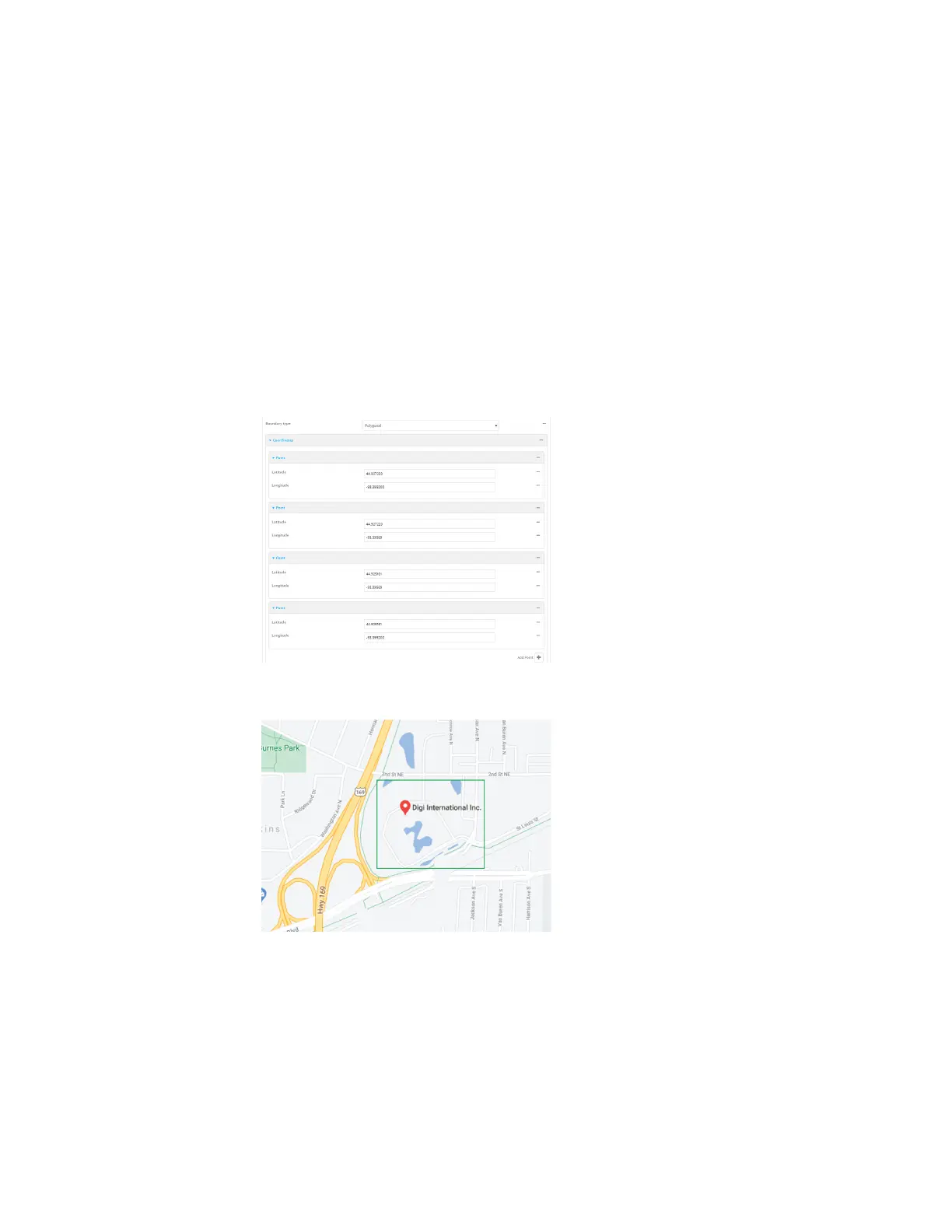
If Polygonal is selected:
a. Click to expand Coordinates.
b. Click to add a point that represents a vertex of the polygon. Avertex is the point
at which two sidesof a polygon meet.
c. Typethe Latitude and Longitude of one of the verticesof the polygon. Allowed
values are:
l
For Latitude, any integer between -90 and 90, with up to six decimal places.
l
For Longitude, any integer between -180 and 180, with up to six decimal
places.
d. Click again to add an additional point, and continue adding points to create the
desired polygon.
For example, to configure a square polygon around the Digi headquarters, configure a
polygon with four points:
This defines a square-shaped polygon equivalent to the following:
7. Define actionsto be taken when the device'slocation triggers a geofence event:
n
To define actionsthat will be taken when the device enters the geofence, or isinside
the geofence when it boots: