Wireless Access Point
Viewing Status on the Wireless AP 129
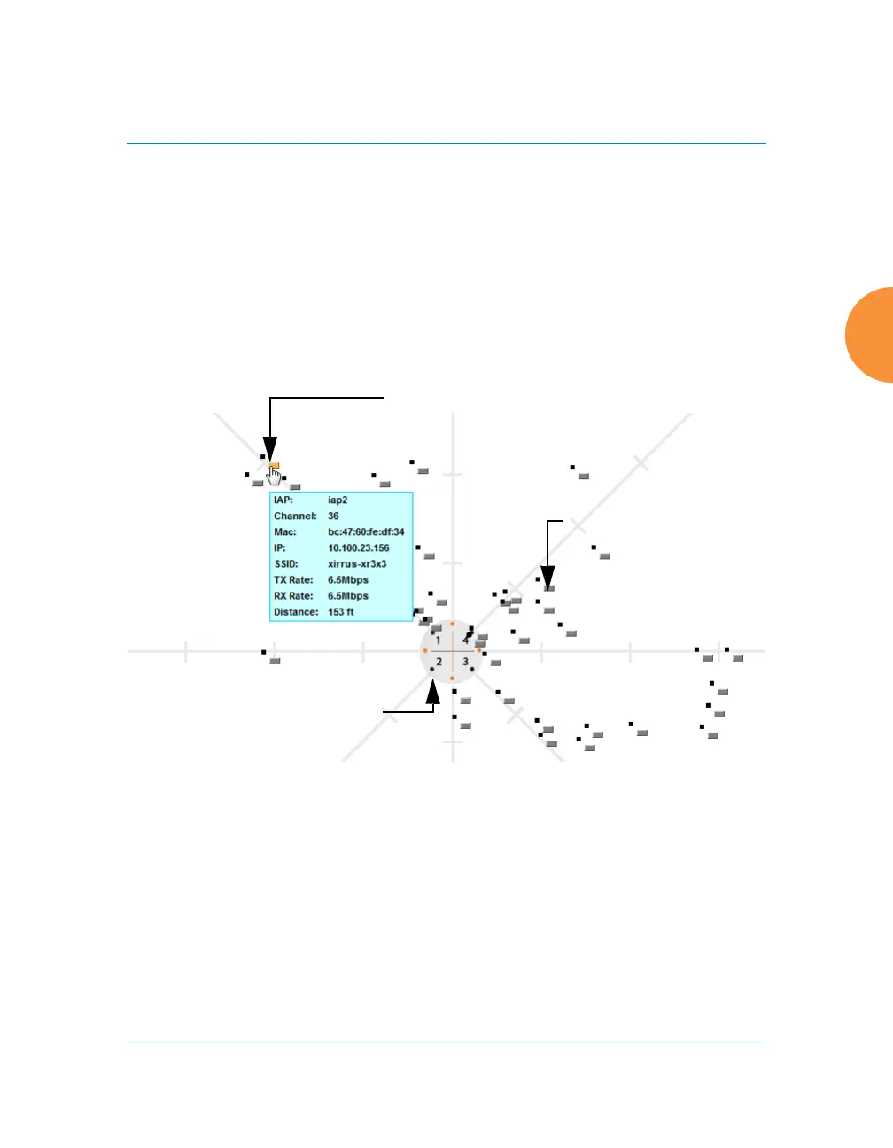
Location Map
The Location Map shows the approximate locations of stations relative to this AP.
The location of each station is computed based on the RSSI of its signal as received
by the AP. The distance is adjusted based on the environment setting that you
selected. You may display just the stations associated to this AP, unassociated
stations (shown in gray), or both. The station count is shown on the right, above
the map. You may also choose to display only 5 GHz stations (shown in orange)
or 2.4 GHz stations (shown in green), or both.
Figure 71. Location Map
The map and AP are shown as if you were looking down on the AP from above,
say from a skylight on the roof. Thus the positions of the radios are a mirror image
of the way they are typically drawn when looking at the face of the AP. Radios are
marked on the map to show the orientation of the AP.
A station is identified by the type of Preferred Label that you select: Netbios
Name, IP Address, MAC Address, or Manufacturer. If multiple stations are near
each other, they will be displayed slightly offset so that one station does not
Associated Stations
orange - 5 GHz
green - 2.4GHz
Unassociated Station
Hover mouse to
show details
AP
 Loading...