14 - 28 Module 5.2 - Mesh Data Extraction
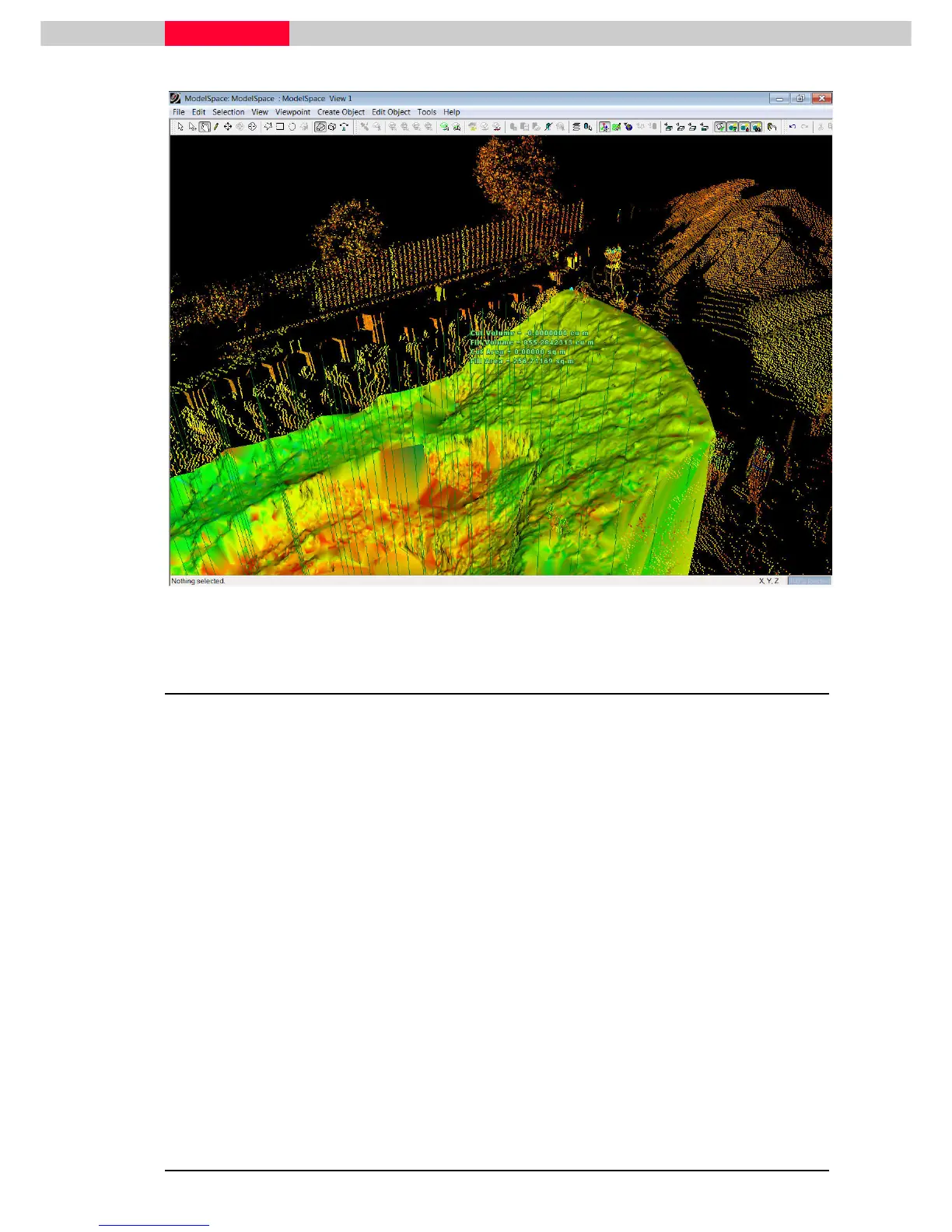
Figure 16
2.2 Measure Surface Deviation
The surface deviation tool measures the elevation differences between the existing (TIN
mesh) and proposed surfaces (TIN mesh or Reference Plane). This can be useful for
excavation and grading projects to establish where a surface needs to be cut (excavated) or
filled to achieve the target surface grade.
The output options are:
•
Cut/Fill Contours using a user-specified major and minor contour interval.
•
Table Output of elevation differences between two surfaces at a user specified grid
sample.
•
Points whose coordinates and elevation in the current UCS correspond to the individual
deviation measurements – this can be used for staking cut/fill values on a user-specified
grid in earthwork applications.