17
.7CitiesandSurfaceobservationstations
layers
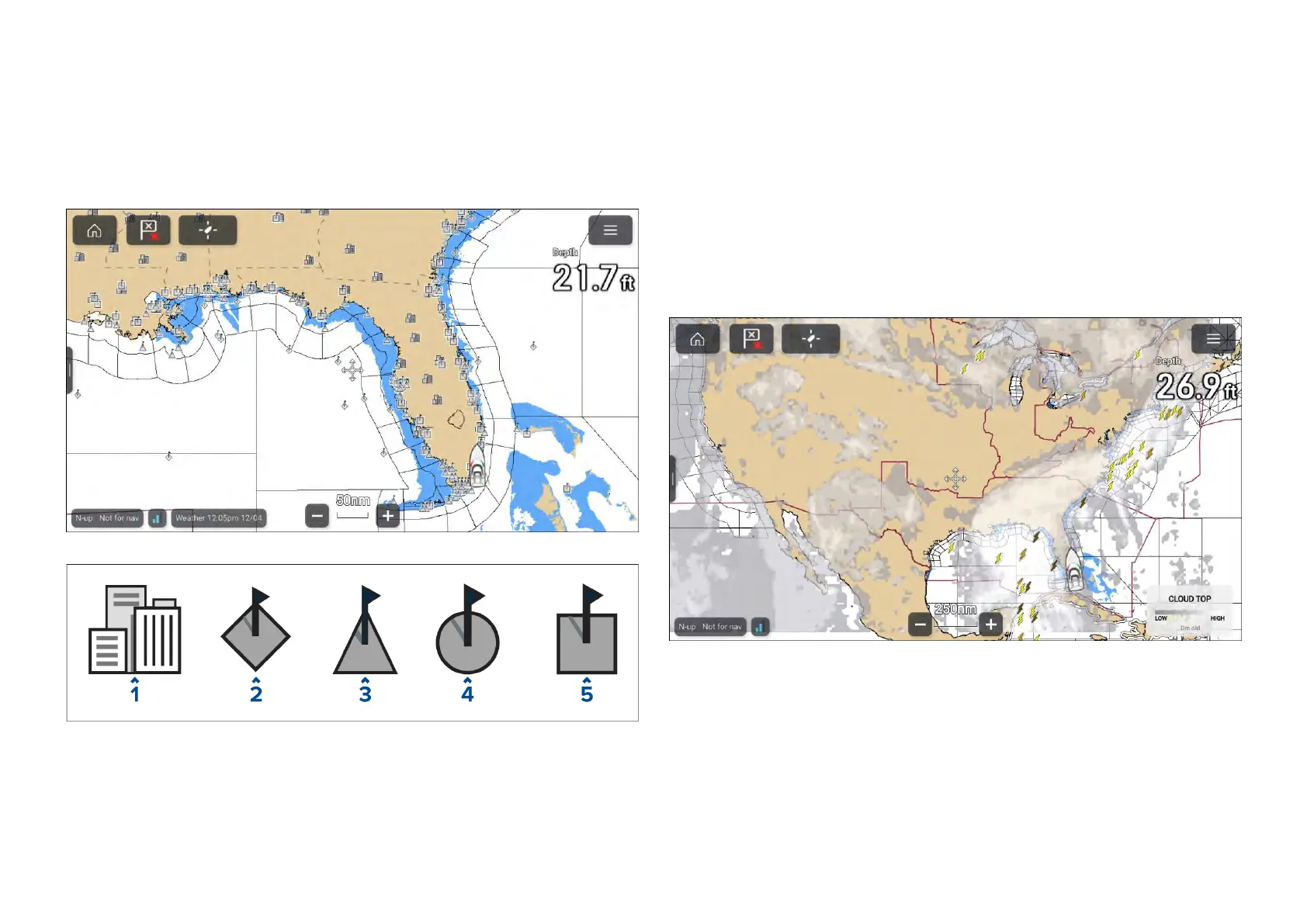
TheCitieslayerandSurfaceobservationstationslayerdisplaysymbolswhich
representthelocationofcitiesandsurfaceobservationstationsrespectively.
Thesymbolsusedforsurfaceobservationstationsalsoidentifythetypeof
station.
Cityforecastsareavailablefromtheconte xtmenuwhenaCityisselected.
1.City
2.Buoystation
3.CMANstation(Coastal-marineautomatednetwork)
4.WSIstation(W
eatherservicesinternational)
5.METARstation(METeorologicalAerodromeReports)
Thecitieslayercanbeenabledanddisabledfromthe[Weatherlayers]menu:
[Menu>Weatherlayers>Cities].
Thesurfaceobservationstationslayercanbeenabledanddisabledfrom
the[Weatherlayers]menu:[Menu>Weatherlayers>Surfaceobservation
stations].
17.8CloudtopandLightninglayers
Thecloudtoplayerprovidesasatelliteimageofcurrentcloudcoverageand
thelightninglayerprovidessymbolstoshowthelocationofrecentlightning
strikes.
Cloudtops
CloudtopsuseGrayshadingtoidentifycloudtopheight.Theshading
changesat5,000feetincrements,fromDarkGraytoWhite.Cloudslower
than5,000feetarenotdisplayed.Alegendisavailablethatcanbedisplayed
onscreentoaididentificationofcloudtopheights.
Thelegendcanbeenabledfromthemainmenu:[Menu>Showlegend].
Thecloudtopslayercanbeenabledanddisabledfromthe[Weatherlayers]
menu:[Menu>Weatherlayers>Cloudtops].
Chartapp-W eathermode
239

 Loading...