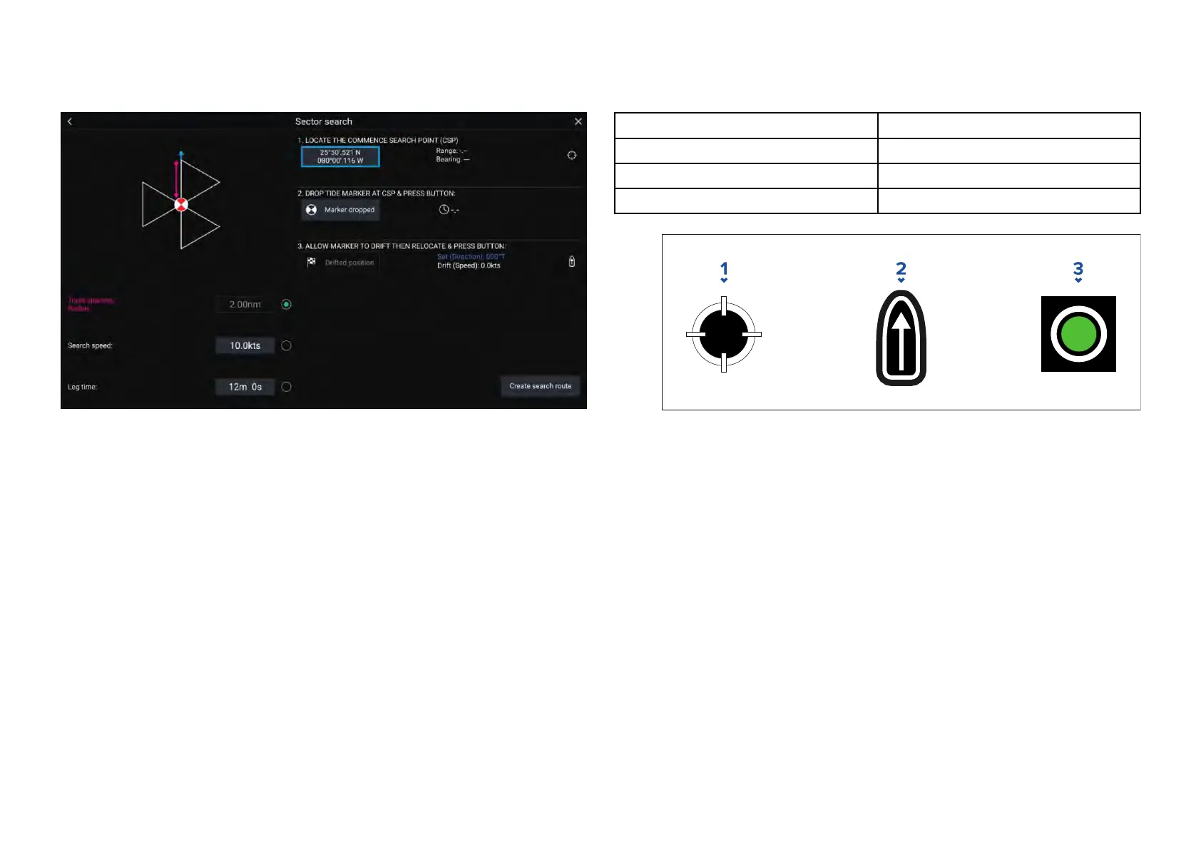
Creatingasectorsearchpattern
T
ocreateaSectorSearchpatternfollowthestepsbelow:
1.Select[SectorSearch]fromthe[SearchP attern]options:[Chartapp>
Menu>Navigate>Searchpatterns]
2.SetCommenceSearchPoint(CSP)
i.Manuallyinputthe[CSP]coordinates;a[Range]and[Bearing]are
displayedtodirectyourvesseltowardsit.
ii.Alternatively,setthe[CSP]asyourvessel’scurrentlocationby
selectingthe
(1)
[CSPShortcut]button.
3.SetDrift
i.Dropthe[DatumMarker]inthewaterandselect[Markerdropped].
ii.Waitforthe[DatumMarker]todriftthroughthewater.
iii.Returntothe[DatumMarker]inthenewlocationandselect[Drift
position]tocalculatethe[Set(Direction)]and[Drift(Speed)].
iv.Alternatively,youcanuseyourvessel’s[Heading]and[SOG]todefine
thesetanddriftbyselectingthe
(2)
[Set/Driftshortcut]icon.
4.SetTrackspacing/Radius,SearchSpeed,andLegtime
[All3variablesaredependentoneachother.Onevariableisalwaysthe
productoftheothertwo.]
i.Selectoneofthevariablesbyselectingthe
(3)
[Output]icon.
ii.Theselectedvariablewillthenbecalculatedasaresultofchanges
madetotheothertwovariables.
V
ariableMaximumValue
T
rackspacing/Radius5nm/5sm/5Km
SearchSpeed
40K
ts/46Mph/74Kph
L
egTime
59m59s
1.[CSPShortcut]
2.[Set/DriftShortcut]
3.[Output]
5.Createsearchroute
[A
fteralltheabovestepshavebeencompletedyoucancreateyour
SARpattern.]
i.Tocreateasearchpattern,selectthe[Createsearchroute]button
inthebottomrightofthescreen.
ii.ThecreationpagewilldisplayyourSARpatterndataanditslocation
ontheChartapp.
144

 Loading...


