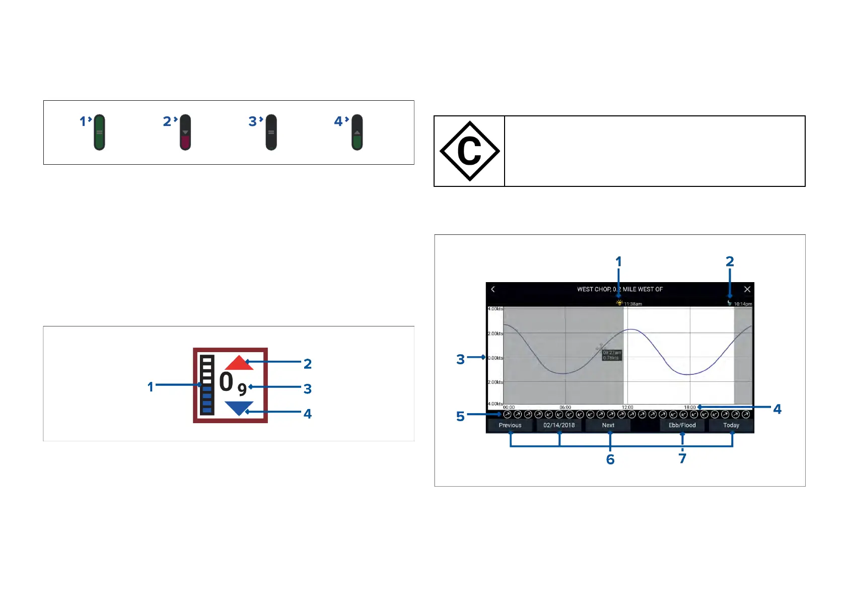
18.6LightHousechartsdynamictidegraphic
WhentheTideslayerisenabledorwhentheChartappisin[Tidesmode],the
standardTidestationsymbolisreplacedwithadynamicTideheightgraphic:
1.Hightide(FullGreenindicatorwithequalssymbol)
2.Decreasingtide(R eddecreasingindicatorwithdownarrow)
3.Lowtide(NearlyemptyGreenindicatorwithequalssymbol)
4.Increasingtide(Greenindicatorwithuparrow)
18.7Navionicsdynamictidegraphic
WhentheTideslayerisenabledorwhentheChartappisin[Tidesmode],the
standardTidestationsymbolisreplacedwithadynamicTideheightgraphic:
1.Tidebar—Thetidebarplotsthecurrenttideheightagainstthemaximum
predictedtideheightforthatday .
2.Redarrowindicatestideheightisincreasing.
3.Tideheight—Tideheightisdisplayedinuser-selecteddepthunits,with
decimalsdisplayedinsubscript.Decimalsarenotshownforvaluesof10
orgreater.
4.Bluearrowindicatestideheightisdecreasing.
18.8Currentstationinformation
Dependingonyourcartography,Currentstationinformationmaybeavailable
atthelocationofCurrentstations.
Currentstationsymbol
ThelocationofCurrentstationsismark
edontheChart
usingadiamond-shapedsymbolwitha‘C’inthemiddle.
Thesymbolcolormayvary.
Currentgraph
Currentgraphscanbeaccessedbyselecting[Currentstation]fromthe
Currentstation’scontextmenu.
1.Sunrise—Indicatestimeofsunrise.
2.Sunset—Indicatestimeofsunset.
3.Speed—Providescurrentspeedinselectedunits.
4.Time—Indicatestimeofday.
250

 Loading...


