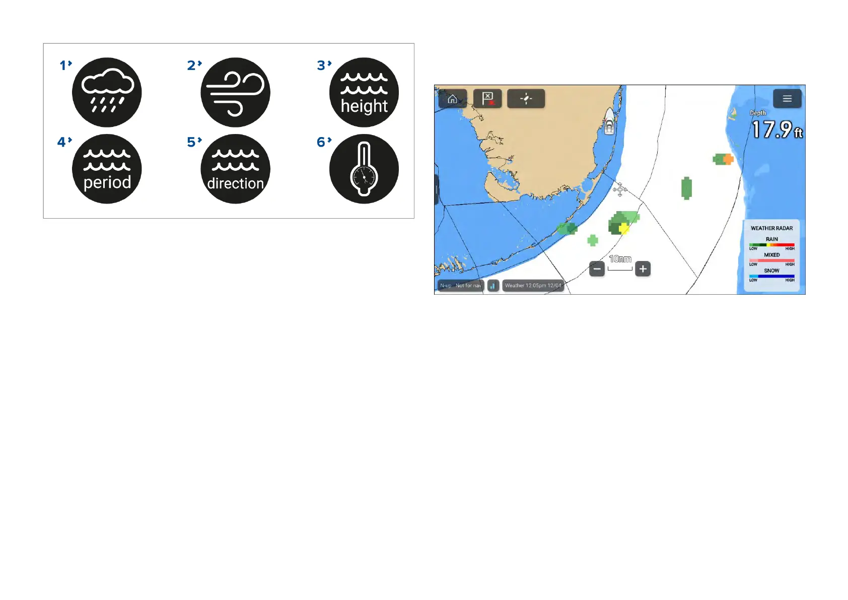
1.[W eatherradar]—Historicalprecipitationdatafortheprevious2hours
canbeplayed.
2.[Wind]—Offshorewindforecastforupto48hours.Highresolution
coastalandinlandwindforecastforupto24hours.
3.[Waveheight]—Offshorewaveheightforecastforupto48hours.High
resolutioncoastalwaveheightforecastforupto24hours.GreatLakes
waveheightforecastforupto24hours.
4.[Waveperiod]—Offshorewaveperiodforecastforupto48hours.Great
Lakeswaveperiodforecastforupto24hours.
5.[Wavedirection]—Offshorewavedirectionforecastforupto48hours.
GreatLakeswavedirectionforecastforupto24hours.
6.[Surfacepressure]—Surfacepressureforecastforupto48hours.
Toexitanimationsopenthe[Menu].
17.6Weatherradarlayer
Withtheweatherradarlayerenabledacolorcodedradarimageisdisplayed.
ThisimageshowsacompleteviewofanyprecipitationacrossNorthAmerica,
includingthetypeandintensity.Rain,mixedandsnowusedifferentcolor
scalestoidentifyintensity.Alegendisavailablethatcanbedisplayed
onscreentoaididentificationofintensity.Theimagesaredisplayedaspixels
onscreenandtheresolutionofthisfeatureis2kmperpixel.Coverage
includestheContinentalUS,Canada,andportionsofMexico/Caribbean.
Thelegendcanbeenabledfromthemainmenu:[Menu>Showlegend].
Theweatherradarlayercanbeenabledanddisabledfromthe[Weather
layers]menu:[Menu>Weatherlayers>Weatherradar].
Whentheweatherradarlayerisenabledthetransparencyofthelayercan
beadjustedusingthe[Visibility]setting:[Menu>Weatherlayers>Weather
radar>Visibility].
238

 Loading...


