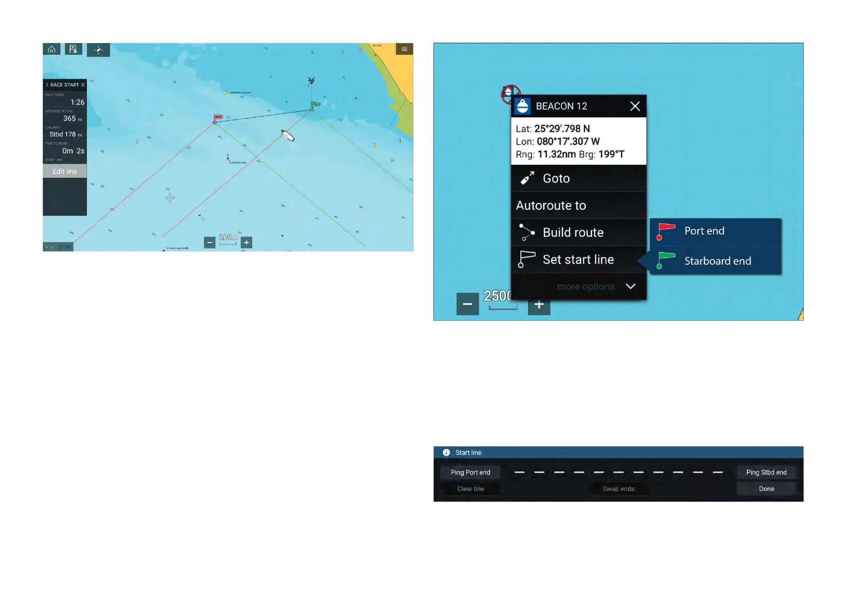
CreatingtheR aceStartLine
ARaceStartLinecanbecreatedbyplacingportandstarboardendpoints.
Theendpointscanbecreatedby:
•PlacingthemanywhereontheChartapp—orforgreateraccuracy—
placingthemusingexistingchartwaypointsandchartobjects(e.g.Buoys).
•Pingingyourvessel’scurrentlocation,usingGPSpositiondata.
Oncebothendpointshavebeenentered,theracestartlinewillbedrawn
betweenthetwopoints.
PlacingtheRaceStartLine
RaceStartLineendpointscanbeplacedanywhereontheChartapp.Y ou
canusewaypointsorchartobjectstoplaceRaceStartLineendpointsat
specificcoordinates.
Toplaceanendpointonawaypointorchartobject:
1.Selectthewaypointorchartobjecttodisplaythecontextmenu.
2.Select[Setstartline].
3.Select[Portend]or[Starboardend].
4.Repeatforthealternateend.
PingingtheRaceStartLine
Y oucanuseyourvessel’slocationtopingeachendoftheRaceStartLine.
Whenyourvesselisattheendpoint:
1.Openthemenu.
2.Select[Racestartline].
3.Selecteither[PingPortend]or[PingStbd(Starboard)end].
4.Repeatforthealternateend.
Chartapp-R acingmode
225

 Loading...


