•Firstresponder
9
.2Routes
Routesareusedtoplanyourjourneyinadvance.Y oucanplanyourjourney
directlyonyourMFD,orathomeusingsoftwarecapableofexporting
WaypointsandRoutesinstandard.gpxformat,suchasRaymarine’sSeapilot
app.
R outesconsistofanumberofwaypoints.YourMFDcanstoreupto250
Routes,eachRouteconsistingofupto500waypoints.TheRoutecapacity
limitissubjecttoyourMFD’s10,000Waypointlimit(forexample,yourMFD
couldstore20Routeseachcontaining500waypoints).
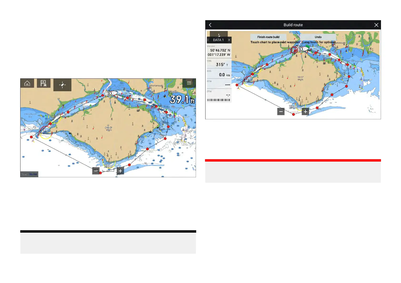
CreatingaRoute
RoutescanbecreatedontheMFDintheChartapp.
Note:
Whencreatingroutesensurethatthewaypointsarefartherapartthanthe
distancespecifiedinthewaypointarrivalalarmsettings.
1.Selectandholdonthelocationforthefirstwaypoint.
2.Select[Buildroute]fromthecontextmenu.
3.Selectthelocationforthesecondwaypoint.
The2waypointswillbejoinedbyaline,creatingthefirstlegofyourroute.
4.Selectthelocationforsubsequentwaypoints.
Important:
Ifyouplaceawaypointinthewronglocationyoucanselect[Undo]atany
timetoremovethelastwaypointplaced.
5.CheckyourRoutewillbesafetofollow,youcanmovethewaypointsin
yourroutebydraggingthemtoanewlocation.
6.WhenyourRouteiscompleteselect[Finishroutebuild].
Routewaypointspacing
Whencreatingroutesthewaypointsmustbespacedfarenoughapartto
ensuretheroutecanbenavigatedsuccessfullybyyourvessel.Vessel
speed,turningcharacteristicsandwaypointarrivalradiuswillallimpacthow
effectivelyaroutecanbenavigated.
IfwaypointsareplacedclosertogetherthantheWaypointarrivalalarmradius
thenwaypointsintheroutemaybeskipped.
134

 Loading...


