11.
11Targetintercept
The[Intercept]featurecanbeusedtohelprendezvouswithfriendsorfor
PilotboatsandtheCoastguardtointerceptvesselsthataretobeboarded.
T
ousethe[Intercept]feature,selectandholdthetargeticonuntil
themenuisdisplayed,thenselect[Intercept].TheChartappwill
automaticallyplotadirectcoursetoapointwhereyourvesseland
thetargetwillcross(intercept).
Aninterceptionmarkisplacedatapredictedpointwherebothyour
vesselandthetargetwillcross.
Important:
Whenperforminganindividualinterception,youareplacingyour
vesselonacollisioncoursewiththetargetvessel.ItWILLbe
necessarytochangetoaparallelcoursetopreventacollision.
Pre-requisites:
•ItisvitaltohaveagoodunderstandingoftheInternationalR egulations
forPreventingCollisionsatSea(IRPCS/COLREGS),toensureallactions
takenareinaccordancewiththeIRPCS.FormoreinformationonIRPCS/
COLREGS,referto:IRPCS
•Y oumustbefamiliarwiththeAISfeature.
•Y oumusthaveathoroughunderstandingoftheTargetinterceptionfeature
anditsimplicationsbeforeattemptingtouseitinareallifescenario.
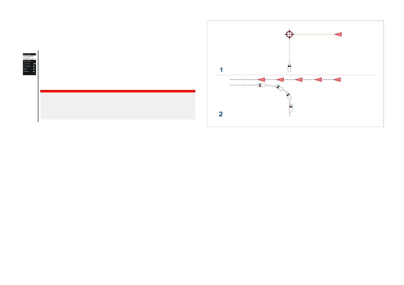
1.InitialTargetinterceptiongraphics.
2.Actualvesselmovementstoperformtherendezvous.
11.12Reedsalmanac
TheReedsalmanacisavailableonRaymarineLightHousecharts.
TheReedsalmanaccoversPortugal,Spain,France,Germany,Netherlands,
Denmark,Ireland/GreatBritain.
ReedsmarinasareonlyavailableinIreland/GreatBritain.
TheReedssymbolsaredisplayedintheChartappwhenthe[Streets&POI]
layerisenabled:[Chartapp>Menu>Settings>Layers>Street&POI].
Chartapp-General
195

 Loading...


