11.
1Chartappchapters
Thisdocumentincludesachartappchapterforeachoftheavailablechart
modes.Thischapterincludesageneraloverviewoftheavailablefeatures
andsettingsofthechartapp.
Toviewdetailsaboutchartmodespecificfeaturesandsettingsrefertothe
relevantchartappchapter:
•p.210—Chartapp-Navigatemode
•p.212—Chartapp-Fishingchartmode
•p.215—Chartapp-Anchormode
•p.234—Chartapp-Weathermode
•p.247—Chartapp-Tidesmode
•p.219—Chartapp-Racingmode
•p.229—Chartapp-Fishmappingmode
11.2Chartappoverview
Thechartappdisplaysarepresentationofyourvesselinrelationtoland
massesandotherchartedobjects,whichenablesyoutoplanandnavigateto
yourdesireddestination.TheChartapprequiresaGNSS(GPS)positionfixin
ordertodisplayyourvesselatthecorrectlocationonaworldmap.Forthe
chartapptorecognisevesseldirectionaheadingsensorisrecommended.If
headingdataisnotavailablethenstableCourseOverGround(COG)may
beused.
Thechartappuseschartmodestoconfigurethechartscreenandsettings
fortherelevantactivity.Fordetailsonavailablechartmodes,referto:
p.154—Chartmodes
Foreachinstanceofthechartappyoucanselectwhichchartmodeand
whichelectroniccartographyyouwanttouse.Theselectionwillbesaved
andpersistoverapowercycle.
Thechartappcanbedisplayedinbothfullscreenandsplitscreenapppages.
Apppagesmayconsistofupto4instancesofthechartapp.
Ifyouareunderwayandusingachartmodethatisnotsuitablefornavigation
itisrecommendedthatyoucreateasplitscreenapppageandusenavigate
modeinoneofthesplitscreenpanes.
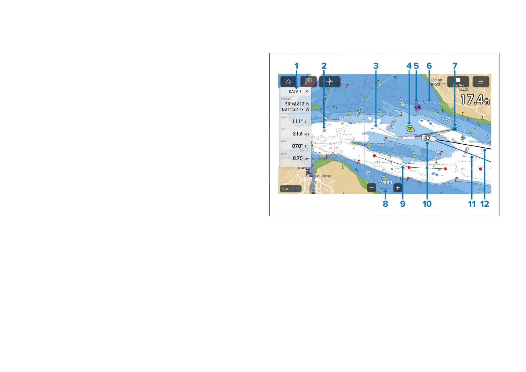
Belowisanoverviewoffeaturesavailableinthechartappsomefeatures
maynotbeavailableinallchartmodes.Ifasettingoptionorfeaturethatyou
arelookingforisnotavailable,trychangingthechartmode.
1.Sidebar—TheSidebarcontainssystemdatathatcanbeviewedinall
apps.
2.Waypoint—Usewaypointstomarkspecificlocationsorpointsof
interest.
3.Track—Y oucanrecordthepassageyourvesseltakesusingTracks.
4.Windindicator—Providesindicationofwinddirectionandspeed(Wind
transducerrequired).
5.Tideindicator—ProvidestideSetandDriftindicators.Requiresthe
followingdata:COG,Heading,SOG,andSTW(SpeedThroughWater).
6.Rangerings—Providesadistanceindicationaroundyourvesselatset
intervals.
7.Destinationwaypoint—DuringaGoto,thisisthecurrentdestination
waypoint.
152

 Loading...


