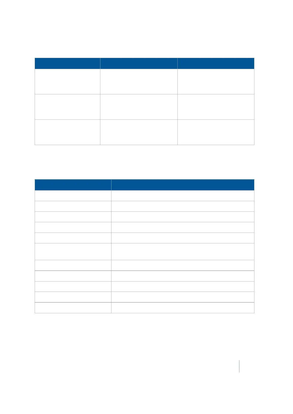
4 Data management Data storage structure
Files stored in this folder are:
Data Explanation Files
Coverage Graphical files containing
polygons
Coverage.shp
Coverage.dbf
Coverage.shx
Track Graphical files containing a series
of 3D points with attributes
Track3D_<date time>.shp
Track3D_<date time>.dbf
Track3D_<date time>.shx
Free Form Guidance Graphical files containing paths
for free form guidance
Swaths.shp
Swaths.shx
Swaths.dbf
Coverage logging file
The display creates a coverage logging file when any application coverage is recorded. For each
coverage polygon, the following information is saved to the coverage logging file.
Data Field Description
AppType Application type ID
AppliedRate Applied rate reported by the variable rate controller
DateClosed Date the polygon was closed
GPS_Status Numeric GPS status value
Height Height in meters
Speed Average GPS ground speed for the polygon (in meters per
second)
Status_Txt GPS status description
Swath The current swath number when coverage was recorded
TimeClosed Time the polygon was closed
Version Coverage attribute file version
XTE Implement Cross Track Error (in meters)
Track logging file
A track logging file is created whenever the event is opened. At each point, a number of attributes
are recorded.
Version 9.25, Revision B FM-1000 Integrated Display User Guide 97