18 Operations Water Management functionality
Status items can be set to always display at the top of the screen or on a slide-out tab. See Status
items (page 70).
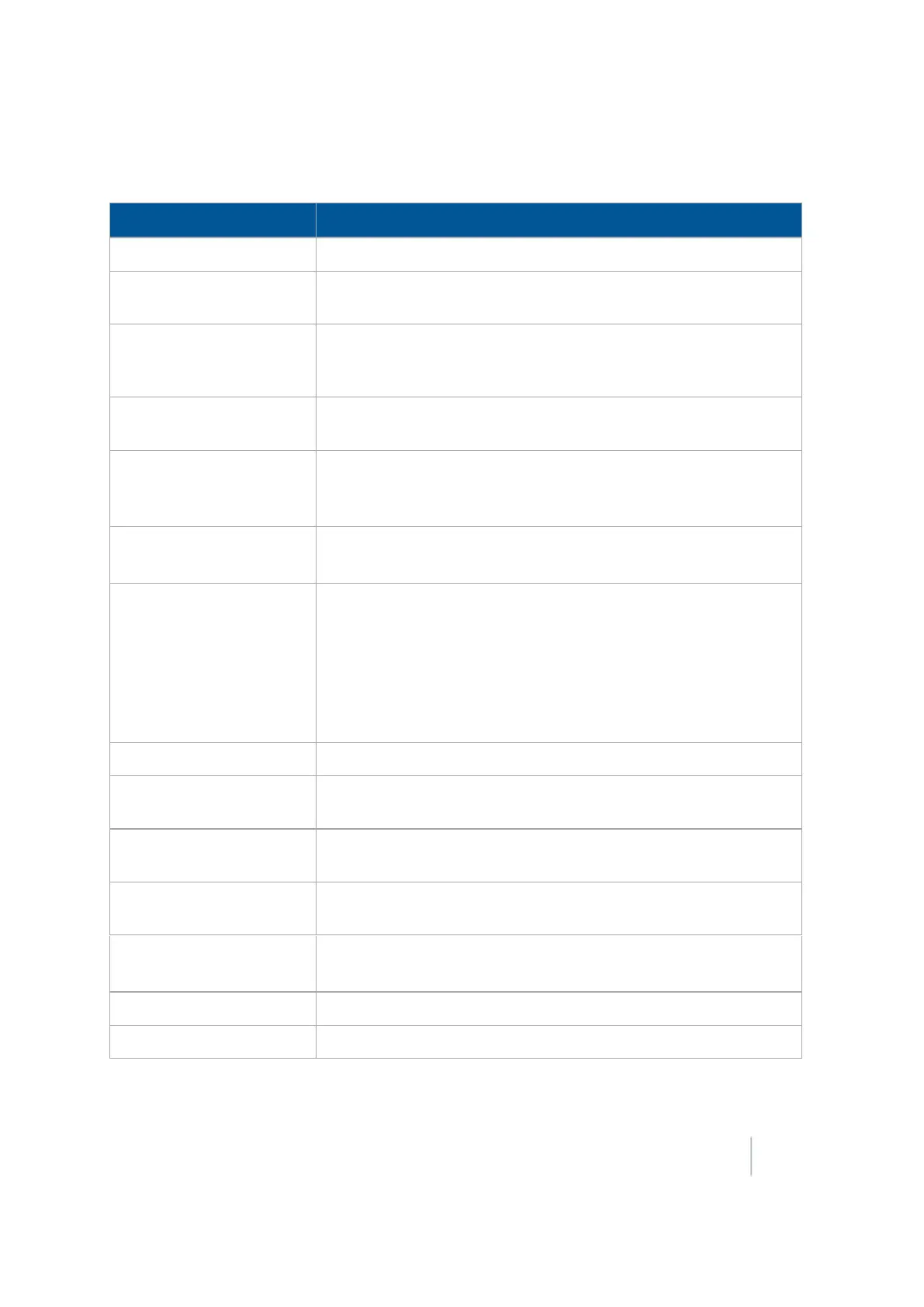
Status Item Explanation
Altitude Current GPS altitude of the blade.
Blade Height Current height of the blade shown as a relative height or a GPS
height depending on settings selected.
Boot Depth Depth of the boot when installing tiles or the depth of the blade
when cleaning surface ditches (used with the Autoslope leveling
model).
CMR Percent Percentage of data being successfully received from the base GPS
receiver.
Correction Age Time since the last GPS correction was received from the GPS base
station.
Note –
Can also be viewed from the Run screen.
Correction Type Solution type (for example: RTK Fixed, or RTK Float, etc.)
Note –
Can also be viewed from the Run screen.
Cut/fill Difference between the blade height and the target height.
When Cut is displayed, the current ground height is above the
target height, and the height adjustment indicator shows a red
down arrow, which means that the blade needs to moved down to
reach the target height.
When Fill is displayed, the current ground height is below the target
height.
Design Height Originally planned or designed height at the current location.
Design Slope Design slope with respect to the current location along the section
line. Used with Autoslope leveling model.
Distance Traveled Distance traveled since Auto mode was enabled. Used with Point to
Slope leveling model.
East Difference in the East component from the Local Tangent Plane
(LTP).
GPS Status Solution type (for example: RTK Fixed, or RTK Float, and so on).
Note –
Can also be viewed from the Run screen.
H Error Current estimate of the error in the horizontal component.
HDOP Horizontal dilution of position. Horizontal component of PDOP.
Version 9.25, Revision B FM-1000 Integrated Display User Guide 447